Kaden geodata
Kaden (Rheinland-Pfalz) is a seat of a fourth-order administrative division; located in Germany in Europe/Berlin (GMT+2) time zone. With population of 655 people, there are 8532 cities with bigger population in this country. Compared to other cities in Germany, 51.8% of cities are located further ↑North; 78.7% of cities are located further →East and 72.4% of cities have lower elevation than Kaden. Note1


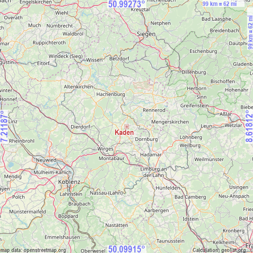
Kaden GPS coordinates[2]
50° 32' 53.016" North, 7° 54' 54" East
| Map corner | latitude | longitude |
|---|---|---|
| Upper-left | 50.99273°, | 7.21187° |
| Center: | 50.54806°, | 7.915° |
| Lower-right: | 50.09915°, | 8.61812° |
| Map W x H: | 99.4×99.4 km | = 61.8×61.8mi |
| max Lat: | 55.01917° ⇑51.8% North |
| Kaden: | 50.54806° |
| min Lat: | ⇓48.2% South 47.40724° |
| min Long | Kaden | max Long |
| 5.92978° | 7.915° | 14.98853° |
| W 21.3%⇐ | ⇒78.7% E |
Elevation
Elevation of Kaden is 377 m = 1237 ft, and this is 127.9 m = 420 ft above average elevation for this country.
| Max E: |
1256 m = 4121 ft | 27.6% |
| Kaden | 377 m 1237 ft | |
| Avg. | 249.1 m = 817 ft | |
Min E: |
-5 m = -16 ft | 72.4% |
See also: Germany elevation on elevation.city.
Geographical zone
Kaden is located in North temperate zone (between Tropic of Cancer and the Arctic Circle). Distance of this North polar circle is 1780.8 km =1106.5 mi to North.| Distance of | km | miles | from Kaden |
|---|---|---|---|
| North Pole | 4386.6 | 2725.7 | to North |
| Arctic Circle | 1780.8 | 1106.5 | to North |
| Tropic Cancer | 3014.5 | 1873.1 | to South |
| Equator | 5620.4 | 3492.4 | to South |


Nearby cities:
15 places around Kaden: (largest is in red/bold)
• Arnshöfen
3.3 km =2.1 mi,  255°
255°
• Brandscheid
1.5 km =0.9 mi,  14°
14°
• Ettinghausen
4.7 km =2.9 mi,  219°
219°
• Girkenroth
5 km =3.1 mi,  126°
126°
• Guckheim
3 km =1.9 mi,  123°
123°
• Härtlingen
2.7 km =1.7 mi,  177°
177°
• Kuhnhöfen
4 km =2.5 mi,  245°
245°
• Kölbingen
1.3 km =0.8 mi,  80°
80°
• Langenhahn
3.9 km =2.4 mi,  1°
1°
• Rothenbach
2 km =1.2 mi,  335°
335°
• Salz
5.5 km =3.4 mi,  140°
140°
• Weltersburg
3.7 km =2.3 mi, 118°
• Westerburg
4.4 km =2.7 mi,  73°
73°
• Willmenrod
4.7 km =2.9 mi,  98°
98°
• Wölferlingen
4.9 km =3 mi,  291°
291°
Sources, notices
• [Note1] Compared only with cities in Germany existing in our database
• [Src1] Map data: © OpenStreetMap contributors (CC-BY-SA)
• [Src2] Other city data from geonames.org with taken over terms of usage.
• [Src3] Geographical zone / Annual Mean Temperature by Robert A. Rohde @ Wikipedia
