Gartow geodata
Gartow (Lower Saxony) is a populated place; located in Germany in Europe/Berlin (GMT+2) time zone. With population of 1,389 people, there are 6099 cities with bigger population in this country. Compared to other cities in Germany, 81.9% of cities are located further ↓South; 73.7% of cities are located further ←West and 90.5% of cities have higher elevation than Gartow. Note1
Administrative division(s):
- Level 1: Lower Saxony
- Level 3: Landkreis Lüchow-Dannenberg
- Level 4: Gartow, Flecken


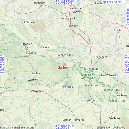
Gartow GPS coordinates[2]
53° 1' 28.92" North, 11° 27' 43.2" East
| Map corner | latitude | longitude |
|---|---|---|
| Upper-left | 53.44554°, | 10.75888° |
| Center: | 53.0247°, | 11.462° |
| Lower-right: | 52.59971°, | 12.16513° |
| Map W x H: | 94×94 km | = 58.4×58.4mi |
| max Lat: | 55.01917° ⇑18.1% North |
| Gartow: | 53.0247° |
| min Lat: | ⇓81.9% South 47.40724° |
| min Long | Gartow | max Long |
| 5.92978° | 11.462° | 14.98853° |
| W 73.7%⇐ | ⇒26.3% E |
Elevation
Elevation of Gartow is 20 m = 66 ft, and this is 229.1 m = 752 ft below average elevation for this country.
| Max E: |
1256 m = 4121 ft | 90.5% |
| Avg. | 249.1 m = 817 ft | |
| Gartow | 20 m = 66 ft | |
Min E: |
-5 m = -16 ft | 9.5% |
See also: Germany elevation on elevation.city.
Geographical zone
Gartow is located in North temperate zone (between Tropic of Cancer and the Arctic Circle). Distance of this North polar circle is 1505.4 km =935.4 mi to North.| Distance of | km | miles | from Gartow |
|---|---|---|---|
| North Pole | 4111.3 | 2554.6 | to North |
| Arctic Circle | 1505.4 | 935.4 | to North |
| Tropic Cancer | 3289.9 | 2044.2 | to South |
| Equator | 5895.8 | 3663.5 | to South |


Nearby cities:
15 places around Gartow: (largest is in red/bold)
• Cumlosen
13.7 km =8.5 mi,  85°
85°
• Dömitz
19.2 km =11.9 mi,  312°
312°
• Gorleben
7.5 km =4.7 mi,  290°
290°
• Groß Garz
14.2 km =8.8 mi,  135°
135°
• Klein Gusborn
19.1 km =11.9 mi, 289°
• Krüden
19.4 km =12.1 mi,  125°
125°
• Langendorf
16.2 km =10.1 mi,  301°
301°
• Lanz
10.7 km =6.6 mi,  58°
58°
• Lenzen
7.5 km =4.7 mi,  6°
6°
• Luftkurort Arendsee
16.1 km =10 mi,  174°
174°
• Prezelle
7.7 km =4.8 mi,  212°
212°
• Schnackenburg
7 km =4.3 mi,  78°
78°
• Trebel
10.1 km =6.3 mi,  254°
254°
• Wittenberge
19.4 km =12.1 mi,  96°
96°
• Woltersdorf
18.4 km =11.4 mi,  243°
243°
Sources, notices
• [Note1] Compared only with cities in Germany existing in our database
• [Src1] Map data: © OpenStreetMap contributors (CC-BY-SA)
• [Src2] Other city data from geonames.org with taken over terms of usage.
• [Src3] Geographical zone / Annual Mean Temperature by Robert A. Rohde @ Wikipedia
