Fell geodata
Fell (Rheinland-Pfalz) is a seat of a fourth-order administrative division; located in Germany in Europe/Berlin (GMT+2) time zone. With population of 2,342 people, there are 4612 cities with bigger population in this country. Compared to other cities in Germany, 69.8% of cities are located further ↑North; 95.8% of cities are located further →East and 54.2% of cities have higher elevation than Fell. Note1
Administrative division(s):
- Level 1: Rheinland-Pfalz
- Level 3: Landkreis Trier-Saarburg
- Level 4: Fell


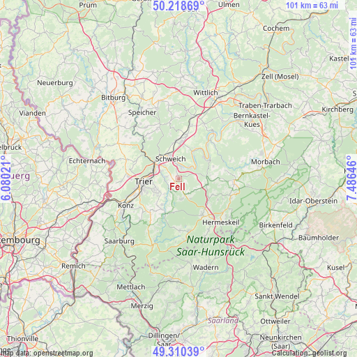
Fell GPS coordinates[2]
49° 46' 0.012" North, 6° 46' 59.988" East
| Map corner | latitude | longitude |
|---|---|---|
| Upper-left | 50.21869°, | 6.08021° |
| Center: | 49.76667°, | 6.78333° |
| Lower-right: | 49.31039°, | 7.48646° |
| Map W x H: | 101×101 km | = 62.8×62.8mi |
| max Lat: | 55.01917° ⇑69.8% North |
| Fell: | 49.76667° |
| min Lat: | ⇓30.2% South 47.40724° |
| min Long | Fell | max Long |
| 5.92978° | 6.78333° | 14.98853° |
| W 4.2%⇐ | ⇒95.8% E |
Elevation
Elevation of Fell is 195 m = 640 ft, and this is 54.1 m = 177 ft below average elevation for this country.
| Max E: |
1256 m = 4121 ft | 54.2% |
| Avg. | 249.1 m = 817 ft | |
| Fell | 195 m = 640 ft | |
Min E: |
-5 m = -16 ft | 45.8% |
See also: Germany elevation on elevation.city.
Geographical zone
Fell is located in North temperate zone (between Tropic of Cancer and the Arctic Circle). Distance of this North polar circle is 1867.6 km =1160.5 mi to North.| Distance of | km | miles | from Fell |
|---|---|---|---|
| North Pole | 4473.5 | 2779.7 | to North |
| Arctic Circle | 1867.6 | 1160.5 | to North |
| Tropic Cancer | 2927.6 | 1819.1 | to South |
| Equator | 5533.5 | 3438.4 | to South |


Nearby cities:
15 places around Fell: (largest is in red/bold)
• Farschweiler
6.1 km =3.8 mi,  156°
156°
• Herl
4.4 km =2.7 mi,  147°
147°
• Kasel
3.7 km =2.3 mi,  261°
261°
• Longen
3.7 km =2.3 mi,  0°
0°
• Longuich
4.8 km =3 mi,  346°
346°
• Lorscheid
6.1 km =3.8 mi,  127°
127°
• Mehring
5.2 km =3.2 mi,  44°
44°
• Mertesdorf
3.7 km =2.3 mi,  279°
279°
• Morscheid
4.4 km =2.7 mi,  212°
212°
• Osburg
5.6 km =3.5 mi,  180°
180°
• Pölich
6.1 km =3.8 mi,  52°
52°
• Riol
3 km =1.9 mi,  12°
12°
• Riveris
5.7 km =3.5 mi,  192°
192°
• Thomm
3.2 km =2 mi, 151°
• Waldrach
3.5 km =2.2 mi,  230°
230°
Sources, notices
• [Note1] Compared only with cities in Germany existing in our database
• [Src1] Map data: © OpenStreetMap contributors (CC-BY-SA)
• [Src2] Other city data from geonames.org with taken over terms of usage.
• [Src3] Geographical zone / Annual Mean Temperature by Robert A. Rohde @ Wikipedia
