Fahrenkrug geodata
Fahrenkrug (Schleswig-Holstein) is a seat of a fourth-order administrative division; located in Germany in Europe/Berlin (GMT+2) time zone. With population of 1,697 people, there are 5517 cities with bigger population in this country. Compared to other cities in Germany, 92% of cities are located further ↓South; 54.3% of cities are located further ←West and 75.8% of cities have higher elevation than Fahrenkrug. Note1


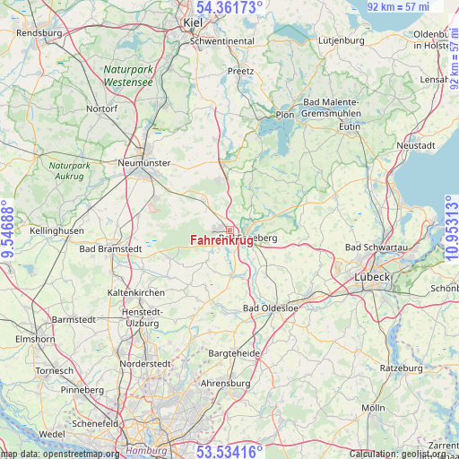
Fahrenkrug GPS coordinates[2]
53° 57' 0" North, 10° 15' 0" East
| Map corner | latitude | longitude |
|---|---|---|
| Upper-left | 54.36173°, | 9.54688° |
| Center: | 53.95°, | 10.25° |
| Lower-right: | 53.53416°, | 10.95313° |
| Map W x H: | 92×92 km | = 57.2×57.2mi |
| max Lat: | 55.01917° ⇑8% North |
| Fahrenkrug: | 53.95° |
| min Lat: | ⇓92% South 47.40724° |
| min Long | Fahrenkrug | max Long |
| 5.92978° | 10.25° | 14.98853° |
| W 54.3%⇐ | ⇒45.7% E |
Elevation
Elevation of Fahrenkrug is 60 m = 197 ft, and this is 189.1 m = 620 ft below average elevation for this country.
| Max E: |
1256 m = 4121 ft | 75.8% |
| Avg. | 249.1 m = 817 ft | |
| Fahrenkrug | 60 m = 197 ft | |
Min E: |
-5 m = -16 ft | 24.2% |
See also: Germany elevation on elevation.city.
Geographical zone
Fahrenkrug is located in North temperate zone (between Tropic of Cancer and the Arctic Circle). Distance of this North polar circle is 1402.5 km =871.5 mi to North.| Distance of | km | miles | from Fahrenkrug |
|---|---|---|---|
| North Pole | 4008.4 | 2490.7 | to North |
| Arctic Circle | 1402.5 | 871.5 | to North |
| Tropic Cancer | 3392.8 | 2108.2 | to South |
| Equator | 5998.7 | 3727.4 | to South |


Nearby cities:
15 places around Fahrenkrug: (largest is in red/bold)
• Bad Segeberg
3.5 km =2.2 mi,  102°
102°
• Bark
6.3 km =3.9 mi,  227°
227°
• Groß Rönnau
4.7 km =2.9 mi,  66°
66°
• Högersdorf
4.3 km =2.7 mi,  149°
149°
• Klein Gladebrügge
5.7 km =3.5 mi,  130°
130°
• Klein Rönnau
4.7 km =2.9 mi, 66°
• Kükels
5.7 km =3.5 mi,  191°
191°
• Mözen
3.7 km =2.3 mi,  180°
180°
• Negernbötel
3.7 km =2.3 mi,  0°
0°
• Schackendorf
1.7 km =1.1 mi,  56°
56°
• Schwissel
6.5 km =4 mi, 149°
• Stipsdorf
5.5 km =3.4 mi,  90°
90°
• Traventhal
7.1 km =4.4 mi,  141°
141°
• Wahlstedt
2.9 km =1.8 mi,  273°
273°
• Wittenborn
3.7 km =2.3 mi,  211°
211°
Sources, notices
• [Note1] Compared only with cities in Germany existing in our database
• [Src1] Map data: © OpenStreetMap contributors (CC-BY-SA)
• [Src2] Other city data from geonames.org with taken over terms of usage.
• [Src3] Geographical zone / Annual Mean Temperature by Robert A. Rohde @ Wikipedia
