Eschenbach geodata
Eschenbach (Baden-Württemberg) is a seat of a fourth-order administrative division; located in Germany in Europe/Berlin (GMT+2) time zone. With population of 2,316 people, there are 4652 cities with bigger population in this country. Compared to other cities in Germany, 87.1% of cities are located further ↑North; 54.8% of cities are located further →East and 76.7% of cities have lower elevation than Eschenbach. Note1
Administrative division(s):
- Level 1: Baden-Württemberg
- Level 2: Regierungsbezirk Stuttgart
- Level 3: Landkreis Göppingen
- Level 4: Eschenbach


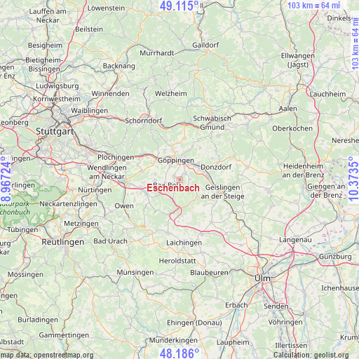
Eschenbach GPS coordinates[2]
48° 39' 9.504" North, 9° 40' 13.332" East
| Map corner | latitude | longitude |
|---|---|---|
| Upper-left | 49.115°, | 8.96724° |
| Center: | 48.65264°, | 9.67037° |
| Lower-right: | 48.186°, | 10.3735° |
| Map W x H: | 103.3×103.3 km | = 64.2×64.2mi |
| max Lat: | 55.01917° ⇑87.1% North |
| Eschenbach: | 48.65264° |
| min Lat: | ⇓12.9% South 47.40724° |
| min Long | Eschenbach | max Long |
| 5.92978° | 9.67037° | 14.98853° |
| W 45.2%⇐ | ⇒54.8% E |
Elevation
Elevation of Eschenbach is 410 m = 1345 ft, and this is 160.9 m = 528 ft above average elevation for this country.
| Max E: |
1256 m = 4121 ft | 23.3% |
| Eschenbach | 410 m 1345 ft | |
| Avg. | 249.1 m = 817 ft | |
Min E: |
-5 m = -16 ft | 76.7% |
See also: Germany elevation on elevation.city.
Geographical zone
Eschenbach is located in North temperate zone (between Tropic of Cancer and the Arctic Circle). Distance of this North polar circle is 1991.5 km =1237.5 mi to North.| Distance of | km | miles | from Eschenbach |
|---|---|---|---|
| North Pole | 4597.4 | 2856.7 | to North |
| Arctic Circle | 1991.5 | 1237.5 | to North |
| Tropic Cancer | 2803.7 | 1742.1 | to South |
| Equator | 5409.7 | 3361.4 | to South |


Nearby cities:
15 places around Eschenbach: (largest is in red/bold)
• Aichelberg
8.1 km =5 mi,  256°
256°
• Bad Ditzenbach
7.6 km =4.7 mi,  160°
160°
• Boll
4.3 km =2.7 mi, 256°
• Deggingen
7.1 km =4.4 mi,  149°
149°
• Dürnau
2.9 km =1.8 mi,  242°
242°
• Eislingen
5.4 km =3.4 mi,  29°
29°
• Gammelshausen
2 km =1.2 mi,  226°
226°
• Gruibingen
6.7 km =4.2 mi,  196°
196°
• Göppingen
5.8 km =3.6 mi,  346°
346°
• Hattenhofen
7.2 km =4.5 mi,  282°
282°
• Heiningen
1.8 km =1.1 mi,  303°
303°
• Salach
6.6 km =4.1 mi,  48°
48°
• Schlat
2.6 km =1.6 mi,  88°
88°
• Süßen
6.9 km =4.3 mi,  64°
64°
• Zell unter Aichelberg
7.3 km =4.5 mi,  266°
266°
Sources, notices
• [Note1] Compared only with cities in Germany existing in our database
• [Src1] Map data: © OpenStreetMap contributors (CC-BY-SA)
• [Src2] Other city data from geonames.org with taken over terms of usage.
• [Src3] Geographical zone / Annual Mean Temperature by Robert A. Rohde @ Wikipedia
