Salach geodata
Salach (Baden-Württemberg) is a seat of a fourth-order administrative division; located in Germany in Europe/Berlin (GMT+2) time zone. With population of 7,778 people, there are 1995 cities with bigger population in this country. Compared to other cities in Germany, 86.6% of cities are located further ↑North; 53.7% of cities are located further →East and 69.4% of cities have lower elevation than Salach. Note1
Administrative division(s):
- Level 1: Baden-Württemberg
- Level 2: Regierungsbezirk Stuttgart
- Level 3: Landkreis Göppingen
- Level 4: Salach


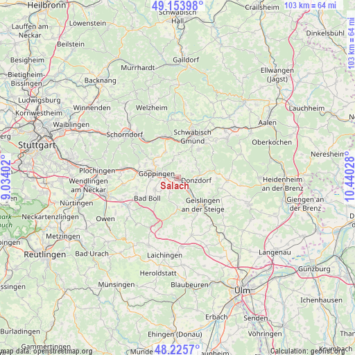
Salach GPS coordinates[2]
48° 41' 31.128" North, 9° 44' 13.74" East
| Map corner | latitude | longitude |
|---|---|---|
| Upper-left | 49.15398°, | 9.03402° |
| Center: | 48.69198°, | 9.73715° |
| Lower-right: | 48.2257°, | 10.44028° |
| Map W x H: | 103.2×103.2 km | = 64.1×64.1mi |
| max Lat: | 55.01917° ⇑86.6% North |
| Salach: | 48.69198° |
| min Lat: | ⇓13.4% South 47.40724° |
| min Long | Salach | max Long |
| 5.92978° | 9.73715° | 14.98853° |
| W 46.3%⇐ | ⇒53.7% E |
Elevation
Elevation of Salach is 354 m = 1161 ft, and this is 104.9 m = 344 ft above average elevation for this country.
| Max E: |
1256 m = 4121 ft | 30.6% |
| Salach | 354 m 1161 ft | |
| Avg. | 249.1 m = 817 ft | |
Min E: |
-5 m = -16 ft | 69.4% |
See also: Germany elevation on elevation.city.
Geographical zone
Salach is located in North temperate zone (between Tropic of Cancer and the Arctic Circle). Distance of this North polar circle is 1987.1 km =1234.7 mi to North.| Distance of | km | miles | from Salach |
|---|---|---|---|
| North Pole | 4593 | 2854 | to North |
| Arctic Circle | 1987.1 | 1234.7 | to North |
| Tropic Cancer | 2808.1 | 1744.9 | to South |
| Equator | 5414 | 3364.1 | to South |


Nearby cities:
15 places around Salach: (largest is in red/bold)
• Birenbach
8.3 km =5.2 mi,  317°
317°
• Donzdorf
5.4 km =3.4 mi,  97°
97°
• Dürnau
9.4 km =5.8 mi,  232°
232°
• Eislingen
2.3 km =1.4 mi,  278°
278°
• Eschenbach
6.6 km =4.1 mi, 228°
• Gammelshausen
8.6 km =5.3 mi, 227°
• Gingen an der Fils
4.8 km =3 mi,  138°
138°
• Göppingen
6.4 km =4 mi, 281°
• Heiningen
7.2 km =4.5 mi,  242°
242°
• Kuchen
7.8 km =4.8 mi, 143°
• Ottenbach
5 km =3.1 mi,  9°
9°
• Rechberghausen
8.1 km =5 mi,  302°
302°
• Schlat
4.9 km =3 mi,  207°
207°
• Süßen
1.9 km =1.2 mi, 136°
• Wäschenbeuren
8.4 km =5.2 mi,  334°
334°
Sources, notices
• [Note1] Compared only with cities in Germany existing in our database
• [Src1] Map data: © OpenStreetMap contributors (CC-BY-SA)
• [Src2] Other city data from geonames.org with taken over terms of usage.
• [Src3] Geographical zone / Annual Mean Temperature by Robert A. Rohde @ Wikipedia
