Ershausen geodata
Ershausen (Thuringia) is a seat of a fourth-order administrative division; located in Germany in Europe/Berlin (GMT+2) time zone. In our database, there are 11009 cities with bigger population. Compared to other cities in Germany, 62.5% of cities are located further ↓South; 52.7% of cities are located further ←West and 50.3% of cities have lower elevation than Ershausen. Note1


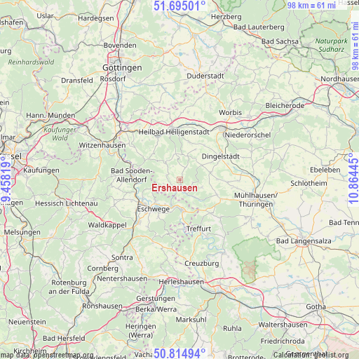
Ershausen GPS coordinates[2]
51° 15' 25.488" North, 10° 9' 40.752" East
| Map corner | latitude | longitude |
|---|---|---|
| Upper-left | 51.69501°, | 9.45819° |
| Center: | 51.25708°, | 10.16132° |
| Lower-right: | 50.81494°, | 10.86445° |
| Map W x H: | 97.9×97.9 km | = 60.8×60.8mi |
| max Lat: | 55.01917° ⇑37.5% North |
| Ershausen: | 51.25708° |
| min Lat: | ⇓62.5% South 47.40724° |
| min Long | Ershausen | max Long |
| 5.92978° | 10.16132° | 14.98853° |
| W 52.7%⇐ | ⇒47.3% E |
Elevation
Elevation of Ershausen is 227 m = 745 ft, and this is 22.1 m = 73 ft below average elevation for this country.
| Max E: |
1256 m = 4121 ft | 49.7% |
| Avg. | 249.1 m = 817 ft | |
| Ershausen | 227 m = 745 ft | |
Min E: |
-5 m = -16 ft | 50.3% |
See also: Germany elevation on elevation.city.
Geographical zone
Ershausen is located in North temperate zone (between Tropic of Cancer and the Arctic Circle). Distance of this North polar circle is 1701.9 km =1057.5 mi to North.| Distance of | km | miles | from Ershausen |
|---|---|---|---|
| North Pole | 4307.8 | 2676.7 | to North |
| Arctic Circle | 1701.9 | 1057.5 | to North |
| Tropic Cancer | 3093.3 | 1922.1 | to South |
| Equator | 5699.3 | 3541.4 | to South |


Nearby cities:
15 places around Ershausen: (largest is in red/bold)
• Dieterode
6.4 km =4 mi,  318°
318°
• Effelder
6.3 km =3.9 mi,  108°
108°
• Eichstruth
7.2 km =4.5 mi,  311°
311°
• Geismar
2.8 km =1.7 mi,  174°
174°
• Großbartloff
3.9 km =2.4 mi,  101°
101°
• Kella
6 km =3.7 mi,  244°
244°
• Krombach
5.2 km =3.2 mi,  337°
337°
• Küllstedt
8.5 km =5.3 mi,  75°
75°
• Mackenrode
8.1 km =5 mi, 305°
• Pfaffschwende
4.3 km =2.7 mi,  259°
259°
• Schwobfeld
5.2 km =3.2 mi,  304°
304°
• Sickerode
3.2 km =2 mi, 255°
• Volkerode
6.7 km =4.2 mi,  279°
279°
• Wachstedt
7.8 km =4.8 mi,  52°
52°
• Wanfried
8.4 km =5.2 mi, 174°
Sources, notices
• [Note1] Compared only with cities in Germany existing in our database
• [Src1] Map data: © OpenStreetMap contributors (CC-BY-SA)
• [Src2] Other city data from geonames.org with taken over terms of usage.
• [Src3] Geographical zone / Annual Mean Temperature by Robert A. Rohde @ Wikipedia
