Pfaffschwende geodata
Pfaffschwende (Thuringia) is a seat of a fourth-order administrative division; located in Germany in Europe/Berlin (GMT+2) time zone. With population of 368 people, there are 9797 cities with bigger population in this country. Compared to other cities in Germany, 62.3% of cities are located further ↓South; 51.6% of cities are located further ←West and 69% of cities have lower elevation than Pfaffschwende. Note1


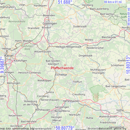
Pfaffschwende GPS coordinates[2]
51° 15' 0" North, 10° 6' 0" East
| Map corner | latitude | longitude |
|---|---|---|
| Upper-left | 51.688°, | 9.39687° |
| Center: | 51.25°, | 10.1° |
| Lower-right: | 50.80779°, | 10.80313° |
| Map W x H: | 97.9×97.9 km | = 60.8×60.8mi |
| max Lat: | 55.01917° ⇑37.7% North |
| Pfaffschwende: | 51.25° |
| min Lat: | ⇓62.3% South 47.40724° |
| min Long | Pfaffschwende | max Long |
| 5.92978° | 10.1° | 14.98853° |
| W 51.6%⇐ | ⇒48.4% E |
Elevation
Elevation of Pfaffschwende is 351 m = 1152 ft, and this is 101.9 m = 334 ft above average elevation for this country.
| Max E: |
1256 m = 4121 ft | 31% |
| Pfaffschwende | 351 m 1152 ft | |
| Avg. | 249.1 m = 817 ft | |
Min E: |
-5 m = -16 ft | 69% |
See also: Germany elevation on elevation.city.
Geographical zone
Pfaffschwende is located in North temperate zone (between Tropic of Cancer and the Arctic Circle). Distance of this North polar circle is 1702.7 km =1058 mi to North.| Distance of | km | miles | from Pfaffschwende |
|---|---|---|---|
| North Pole | 4308.6 | 2677.2 | to North |
| Arctic Circle | 1702.7 | 1058 | to North |
| Tropic Cancer | 3092.5 | 1921.6 | to South |
| Equator | 5698.5 | 3540.9 | to South |


Nearby cities:
15 places around Pfaffschwende: (largest is in red/bold)
• Bad Sooden-Allendorf
9 km =5.6 mi,  284°
284°
• Dieterode
5.6 km =3.5 mi,  0°
0°
• Eichstruth
5.7 km =3.5 mi,  348°
348°
• Ershausen
4.3 km =2.7 mi,  79°
79°
• Eschwege
8 km =5 mi,  203°
203°
• Geismar
5 km =3.1 mi,  114°
114°
• Großbartloff
8.1 km =5 mi,  90°
90°
• Kella
2.2 km =1.4 mi,  212°
212°
• Krombach
6 km =3.7 mi,  22°
22°
• Mackenrode
6 km =3.7 mi,  337°
337°
• Schwobfeld
3.7 km =2.3 mi, 0°
• Sickerode
1.2 km =0.7 mi, 90°
• Volkerode
3 km =1.9 mi,  308°
308°
• Wanfried
9.1 km =5.7 mi,  146°
146°
• Wüstheuterode
8.6 km =5.3 mi, 340°
Sources, notices
• [Note1] Compared only with cities in Germany existing in our database
• [Src1] Map data: © OpenStreetMap contributors (CC-BY-SA)
• [Src2] Other city data from geonames.org with taken over terms of usage.
• [Src3] Geographical zone / Annual Mean Temperature by Robert A. Rohde @ Wikipedia
