Emmelshausen geodata
Emmelshausen (Rheinland-Pfalz) is a seat of a fourth-order administrative division; located in Germany in Europe/Berlin (GMT+2) time zone. With population of 4,889 people, there are 2863 cities with bigger population in this country. Compared to other cities in Germany, 59.9% of cities are located further ↑North; 85.9% of cities are located further →East and 84.4% of cities have lower elevation than Emmelshausen. Note1
Administrative division(s):
- Level 1: Rheinland-Pfalz
- Level 3: Rhein-Hunsrück-Kreis
- Level 4: Emmelshausen


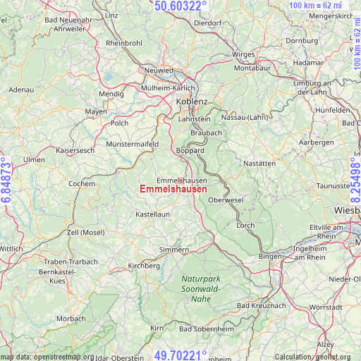
Emmelshausen GPS coordinates[2]
50° 9' 17.424" North, 7° 33' 6.66" East
| Map corner | latitude | longitude |
|---|---|---|
| Upper-left | 50.60322°, | 6.84873° |
| Center: | 50.15484°, | 7.55185° |
| Lower-right: | 49.70221°, | 8.25498° |
| Map W x H: | 100.2×100.2 km | = 62.3×62.3mi |
| max Lat: | 55.01917° ⇑59.9% North |
| Emmelshausen: | 50.15484° |
| min Lat: | ⇓40.1% South 47.40724° |
| min Long | Emmelshausen | max Long |
| 5.92978° | 7.55185° | 14.98853° |
| W 14.1%⇐ | ⇒85.9% E |
Elevation
Elevation of Emmelshausen is 464 m = 1522 ft, and this is 214.9 m = 705 ft above average elevation for this country.
| Max E: |
1256 m = 4121 ft | 15.6% |
| Emmelshausen | 464 m 1522 ft | |
| Avg. | 249.1 m = 817 ft | |
Min E: |
-5 m = -16 ft | 84.4% |
See also: Germany elevation on elevation.city.
Geographical zone
Emmelshausen is located in North temperate zone (between Tropic of Cancer and the Arctic Circle). Distance of this North polar circle is 1824.5 km =1133.7 mi to North.| Distance of | km | miles | from Emmelshausen |
|---|---|---|---|
| North Pole | 4430.4 | 2752.9 | to North |
| Arctic Circle | 1824.5 | 1133.7 | to North |
| Tropic Cancer | 2970.8 | 1846 | to South |
| Equator | 5576.7 | 3465.2 | to South |


Nearby cities:
15 places around Emmelshausen: (largest is in red/bold)
• Bickenbach
3.7 km =2.3 mi,  207°
207°
• Dörth
2.3 km =1.4 mi,  103°
103°
• Gondershausen
3.7 km =2.3 mi,  261°
261°
• Halsenbach
1.9 km =1.2 mi,  10°
10°
• Hungenroth
4.2 km =2.6 mi,  124°
124°
• Karbach
4.6 km =2.9 mi, 96°
• Kratzenburg
3.2 km =2 mi,  357°
357°
• Leiningen
2.6 km =1.6 mi,  156°
156°
• Mühlpfad
3.8 km =2.4 mi,  176°
176°
• Ney
3.4 km =2.1 mi,  337°
337°
• Niedert
2.7 km =1.7 mi, 208°
• Norath
3.3 km =2.1 mi,  136°
136°
• Pfalzfeld
5.1 km =3.2 mi, 158°
• Schwall
0.6 km =0.4 mi,  193°
193°
• Thörlingen
2.7 km =1.7 mi, 208°
Sources, notices
• [Note1] Compared only with cities in Germany existing in our database
• [Src1] Map data: © OpenStreetMap contributors (CC-BY-SA)
• [Src2] Other city data from geonames.org with taken over terms of usage.
• [Src3] Geographical zone / Annual Mean Temperature by Robert A. Rohde @ Wikipedia
