Bickenbach geodata
Bickenbach (Rheinland-Pfalz) is a seat of a fourth-order administrative division; located in Germany in Europe/Berlin (GMT+2) time zone. With population of 341 people, there are 9912 cities with bigger population in this country. Compared to other cities in Germany, 60.8% of cities are located further ↑North; 86.5% of cities are located further →East and 77.4% of cities have lower elevation than Bickenbach. Note1
Administrative division(s):
- Level 1: Rheinland-Pfalz
- Level 3: Rhein-Hunsrück-Kreis
- Level 4: Bickenbach


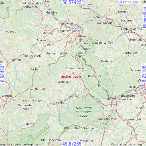
Bickenbach GPS coordinates[2]
50° 7' 32.124" North, 7° 31' 40.62" East
| Map corner | latitude | longitude |
|---|---|---|
| Upper-left | 50.57425°, | 6.82483° |
| Center: | 50.12559°, | 7.52795° |
| Lower-right: | 49.67269°, | 8.23108° |
| Map W x H: | 100.2×100.2 km | = 62.3×62.3mi |
| max Lat: | 55.01917° ⇑60.8% North |
| Bickenbach: | 50.12559° |
| min Lat: | ⇓39.2% South 47.40724° |
| min Long | Bickenbach | max Long |
| 5.92978° | 7.52795° | 14.98853° |
| W 13.5%⇐ | ⇒86.5% E |
Elevation
Elevation of Bickenbach is 415 m = 1362 ft, and this is 165.9 m = 544 ft above average elevation for this country.
| Max E: |
1256 m = 4121 ft | 22.6% |
| Bickenbach | 415 m 1362 ft | |
| Avg. | 249.1 m = 817 ft | |
Min E: |
-5 m = -16 ft | 77.4% |
See also: Germany elevation on elevation.city.
Geographical zone
Bickenbach is located in North temperate zone (between Tropic of Cancer and the Arctic Circle). Distance of this North polar circle is 1827.7 km =1135.7 mi to North.| Distance of | km | miles | from Bickenbach |
|---|---|---|---|
| North Pole | 4433.6 | 2754.9 | to North |
| Arctic Circle | 1827.7 | 1135.7 | to North |
| Tropic Cancer | 2967.5 | 1843.9 | to South |
| Equator | 5573.4 | 3463.1 | to South |


Nearby cities:
15 places around Bickenbach: (largest is in red/bold)
• Beltheim
5.2 km =3.2 mi,  245°
245°
• Braunshorn
4.8 km =3 mi,  189°
189°
• Dörth
4.8 km =3 mi,  55°
55°
• Emmelshausen
3.7 km =2.3 mi,  27°
27°
• Gondershausen
3.4 km =2.1 mi,  323°
323°
• Hausbay
3.1 km =1.9 mi,  133°
133°
• Hungenroth
5.2 km =3.2 mi,  80°
80°
• Leiningen
2.9 km =1.8 mi,  72°
72°
• Lingerhahn
4.4 km =2.7 mi,  143°
143°
• Mühlpfad
2 km =1.2 mi,  104°
104°
• Niedert
0.9 km =0.6 mi,  24°
24°
• Norath
4 km =2.5 mi, 77°
• Pfalzfeld
3.9 km =2.4 mi,  112°
112°
• Schwall
3.1 km =1.9 mi, 30°
• Thörlingen
0.9 km =0.6 mi, 24°
Sources, notices
• [Note1] Compared only with cities in Germany existing in our database
• [Src1] Map data: © OpenStreetMap contributors (CC-BY-SA)
• [Src2] Other city data from geonames.org with taken over terms of usage.
• [Src3] Geographical zone / Annual Mean Temperature by Robert A. Rohde @ Wikipedia
