Elmenhorst geodata
Elmenhorst (Mecklenburg-Vorpommern) is a populated place; located in Germany in Europe/Berlin (GMT+2) time zone. With population of 4,273 people, there are 3149 cities with bigger population in this country. Compared to other cities in Germany, 94.5% of cities are located further ↓South; 81.9% of cities are located further ←West and 93.1% of cities have higher elevation than Elmenhorst. Note1
Administrative division(s):
- Level 1: Mecklenburg-Vorpommern
- Level 3: Landkreis Rostock
- Level 4: Elmenhorst/Lichtenhagen


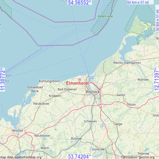
Elmenhorst GPS coordinates[2]
54° 9' 20.988" North, 12° 0' 39.024" East
| Map corner | latitude | longitude |
|---|---|---|
| Upper-left | 54.56552°, | 11.30772° |
| Center: | 54.15583°, | 12.01084° |
| Lower-right: | 53.74204°, | 12.71397° |
| Map W x H: | 91.6×91.6 km | = 56.9×56.9mi |
| max Lat: | 55.01917° ⇑5.5% North |
| Elmenhorst: | 54.15583° |
| min Lat: | ⇓94.5% South 47.40724° |
| min Long | Elmenhorst | max Long |
| 5.92978° | 12.01084° | 14.98853° |
| W 81.9%⇐ | ⇒18.1% E |
Elevation
Elevation of Elmenhorst is 13 m = 43 ft, and this is 236.1 m = 775 ft below average elevation for this country.
| Max E: |
1256 m = 4121 ft | 93.1% |
| Avg. | 249.1 m = 817 ft | |
| Elmenhorst | 13 m = 43 ft | |
Min E: |
-5 m = -16 ft | 6.9% |
See also: Germany elevation on elevation.city.
Geographical zone
Elmenhorst is located in North temperate zone (between Tropic of Cancer and the Arctic Circle). Distance of this North polar circle is 1379.6 km =857.2 mi to North.| Distance of | km | miles | from Elmenhorst |
|---|---|---|---|
| North Pole | 3985.5 | 2476.5 | to North |
| Arctic Circle | 1379.6 | 857.2 | to North |
| Tropic Cancer | 3415.6 | 2122.4 | to South |
| Equator | 6021.6 | 3741.6 | to South |


Nearby cities:
15 places around Elmenhorst: (largest is in red/bold)
• Admannshagen-Bargeshagen
2.9 km =1.8 mi,  195°
195°
• Bad Doberan
9 km =5.6 mi,  233°
233°
• Bartenshagen-Parkentin
8.6 km =5.3 mi,  194°
194°
• Bentwisch
13.4 km =8.3 mi,  109°
109°
• Börgerende-Rethwisch
5.8 km =3.6 mi,  254°
254°
• Dierkow-Neu
11.6 km =7.2 mi,  118°
118°
• Dierkow-West
10.6 km =6.6 mi, 121°
• Kritzmow
11.8 km =7.3 mi,  166°
166°
• Lambrechtshagen
6 km =3.7 mi,  176°
176°
• Mönchhagen
13.4 km =8.3 mi,  92°
92°
• Nienhagen
10.7 km =6.6 mi, 94°
• Reddelich
12.8 km =8 mi, 234°
• Rostock
11.3 km =7 mi,  131°
131°
• Stäbelow
12.8 km =8 mi, 176°
• Warnemünde
5.3 km =3.3 mi,  64°
64°
Sources, notices
• [Note1] Compared only with cities in Germany existing in our database
• [Src1] Map data: © OpenStreetMap contributors (CC-BY-SA)
• [Src2] Other city data from geonames.org with taken over terms of usage.
• [Src3] Geographical zone / Annual Mean Temperature by Robert A. Rohde @ Wikipedia
