Börgerende-Rethwisch geodata
Börgerende-Rethwisch (Mecklenburg-Vorpommern) is a populated place; located in Germany in Europe/Berlin (GMT+2) time zone. With population of 1,744 people, there are 5433 cities with bigger population in this country. Compared to other cities in Germany, 94.4% of cities are located further ↓South; 80.7% of cities are located further ←West and 98.6% of cities have higher elevation than Börgerende-Rethwisch. Note1
Administrative division(s):
- Level 1: Mecklenburg-Vorpommern
- Level 3: Landkreis Rostock
- Level 4: Börgerende-Rethwisch


Börgerende-Rethwisch GPS coordinates[2]
54° 8' 30.372" North, 11° 55' 31.008" East
| Map corner | latitude | longitude |
|---|---|---|
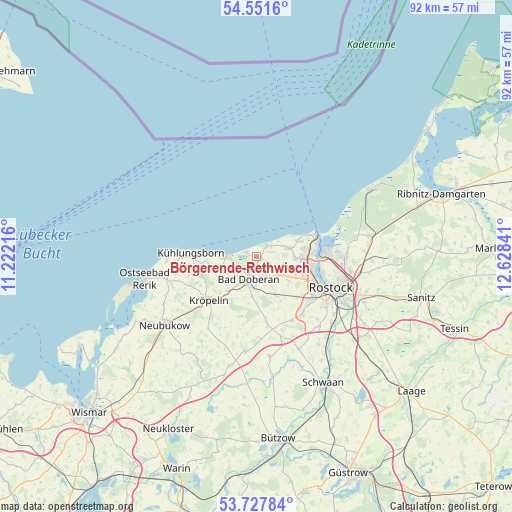
| Upper-left | 54.5516°, | 11.22216° |
| Center: | 54.14177°, | 11.92528° |
| Lower-right: | 53.72784°, | 12.62841° |
| Map W x H: | 91.6×91.6 km | = 56.9×56.9mi |
| max Lat: | 55.01917° ⇑5.6% North |
| Börgerende-Rethwisch: | 54.14177° |
| min Lat: | ⇓94.4% South 47.40724° |
| min Long | Börgerende-Ret | max Long |
| 5.92978° | 11.92528° | 14.98853° |
| W 80.7%⇐ | ⇒19.3% E |
Elevation
Elevation of Börgerende-Rethwisch is 1 m = 3 ft, and this is 248.1 m = 814 ft below average elevation for this country.
| Max E: |
1256 m = 4121 ft | 98.6% |
| Avg. | 249.1 m = 817 ft | |
| Börgerende-Rethwisch | 1 m = 3 ft | |
Min E: |
-5 m = -16 ft | 1.4% |
See also: Germany elevation on elevation.city.
Geographical zone
Börgerende-Rethwisch is located in North temperate zone (between Tropic of Cancer and the Arctic Circle). Distance of this North polar circle is 1381.2 km =858.2 mi to North.| Distance of | km | miles | from Börgerende-Rethwisch |
|---|---|---|---|
| North Pole | 3987.1 | 2477.5 | to North |
| Arctic Circle | 1381.2 | 858.2 | to North |
| Tropic Cancer | 3414.1 | 2121.4 | to South |
| Equator | 6020 | 3740.7 | to South |


Nearby cities:
15 places around Börgerende-Rethwisch: (largest is in red/bold)
• Admannshagen-Bargeshagen
5 km =3.1 mi,  104°
104°
• Bad Doberan
4.2 km =2.6 mi,  202°
202°
• Bartenshagen-Parkentin
7.6 km =4.7 mi,  152°
152°
• Elmenhorst
5.8 km =3.6 mi,  74°
74°
• Jennewitz
10.3 km =6.4 mi,  239°
239°
• Kritzmow
13 km =8.1 mi,  140°
140°
• Kröpelin
11.7 km =7.3 mi,  226°
226°
• Lambrechtshagen
7.4 km =4.6 mi,  126°
126°
• Ostseebad Kühlungsborn
10.8 km =6.7 mi,  275°
275°
• Reddelich
7.6 km =4.7 mi,  219°
219°
• Retschow
11.1 km =6.9 mi, 196°
• Steffenshagen
7.9 km =4.9 mi, 238°
• Stäbelow
12.9 km =8 mi, 150°
• Warnemünde
11 km =6.8 mi, 69°
• Wittenbeck
9.2 km =5.7 mi,  256°
256°
Sources, notices
• [Note1] Compared only with cities in Germany existing in our database
• [Src1] Map data: © OpenStreetMap contributors (CC-BY-SA)
• [Src2] Other city data from geonames.org with taken over terms of usage.
• [Src3] Geographical zone / Annual Mean Temperature by Robert A. Rohde @ Wikipedia
