Breege geodata
Breege (Mecklenburg-Vorpommern) is a populated place; located in Germany in Europe/Berlin (GMT+2) time zone. With population of 779 people, there are 7985 cities with bigger population in this country. Compared to other cities in Germany, 98.6% of cities are located further ↓South; 94.8% of cities are located further ←West and 98.1% of cities have higher elevation than Breege. Note1
Administrative division(s):
- Level 1: Mecklenburg-Vorpommern
- Level 3: Vorpommern-Rügen
- Level 4: Breege


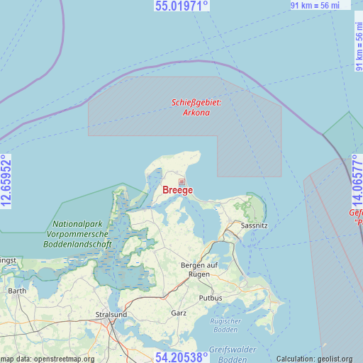
Breege GPS coordinates[2]
54° 36' 52.488" North, 13° 21' 45.504" East
| Map corner | latitude | longitude |
|---|---|---|
| Upper-left | 55.01971°, | 12.65952° |
| Center: | 54.61458°, | 13.36264° |
| Lower-right: | 54.20538°, | 14.06577° |
| Map W x H: | 90.5×90.5 km | = 56.2×56.2mi |
| max Lat: | 55.01917° ⇑1.4% North |
| Breege: | 54.61458° |
| min Lat: | ⇓98.6% South 47.40724° |
| min Long | Breege | max Long |
| 5.92978° | 13.36264° | 14.98853° |
| W 94.8%⇐ | ⇒5.2% E |
Elevation
Elevation of Breege is 2 m = 7 ft, and this is 247.1 m = 811 ft below average elevation for this country.
| Max E: |
1256 m = 4121 ft | 98.1% |
| Avg. | 249.1 m = 817 ft | |
| Breege | 2 m = 7 ft | |
Min E: |
-5 m = -16 ft | 1.9% |
See also: Germany elevation on elevation.city.
Geographical zone
Breege is located in North temperate zone (between Tropic of Cancer and the Arctic Circle). Distance of this North polar circle is 1328.6 km =825.6 mi to North.| Distance of | km | miles | from Breege |
|---|---|---|---|
| North Pole | 3934.5 | 2444.8 | to North |
| Arctic Circle | 1328.6 | 825.6 | to North |
| Tropic Cancer | 3466.7 | 2154.1 | to South |
| Equator | 6072.6 | 3773.3 | to South |


Nearby cities:
15 places around Breege: (largest is in red/bold)
• Altenkirchen
2.7 km =1.7 mi,  332°
332°
• Bergen auf Rügen
22.3 km =13.9 mi,  168°
168°
• Dranske
8.8 km =5.5 mi,  282°
282°
• Gingst
18.8 km =11.7 mi,  201°
201°
• Glowe
8.3 km =5.2 mi,  127°
127°
• Hiddensee
17.5 km =10.9 mi,  252°
252°
• Lohme
16.4 km =10.2 mi,  102°
102°
• Parchtitz
19.8 km =12.3 mi, 173°
• Patzig
16.8 km =10.4 mi, 172°
• Sagard
15.8 km =9.8 mi, 128°
• Saßnitz
21.2 km =13.2 mi,  121°
121°
• Schaprode
16.9 km =10.5 mi,  228°
228°
• Trent
12.5 km =7.8 mi,  213°
213°
• Ummanz
21.4 km =13.3 mi, 206°
• Wiek
4.8 km =3 mi, 277°
Sources, notices
• [Note1] Compared only with cities in Germany existing in our database
• [Src1] Map data: © OpenStreetMap contributors (CC-BY-SA)
• [Src2] Other city data from geonames.org with taken over terms of usage.
• [Src3] Geographical zone / Annual Mean Temperature by Robert A. Rohde @ Wikipedia
