Böxlund geodata
Böxlund (Schleswig-Holstein) is a seat of a fourth-order administrative division; located in Germany in Europe/Berlin (GMT+2) time zone. In our database, there are 11009 cities with bigger population. Compared to other cities in Germany, 99.9% of cities are located further ↓South; 62.7% of cities are located further →East and 89.7% of cities have higher elevation than Böxlund. Note1
Administrative division(s):
- Level 1: Schleswig-Holstein
- Level 3: Kreis Schleswig-Flensburg
- Level 4: Böxlund


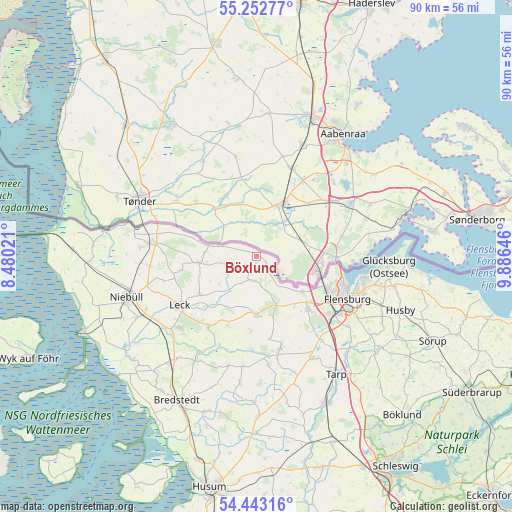
Böxlund GPS coordinates[2]
54° 51' 0" North, 9° 10' 59.988" East
| Map corner | latitude | longitude |
|---|---|---|
| Upper-left | 55.25277°, | 8.48021° |
| Center: | 54.85°, | 9.18333° |
| Lower-right: | 54.44316°, | 9.88646° |
| Map W x H: | 90×90 km | = 55.9×55.9mi |
| max Lat: | 55.01917° ⇑0.1% North |
| Böxlund: | 54.85° |
| min Lat: | ⇓99.9% South 47.40724° |
| min Long | Böxlund | max Long |
| 5.92978° | 9.18333° | 14.98853° |
| W 37.3%⇐ | ⇒62.7% E |
Elevation
Elevation of Böxlund is 22 m = 72 ft, and this is 227.1 m = 745 ft below average elevation for this country.
| Max E: |
1256 m = 4121 ft | 89.7% |
| Avg. | 249.1 m = 817 ft | |
| Böxlund | 22 m = 72 ft | |
Min E: |
-5 m = -16 ft | 10.3% |
See also: Germany elevation on elevation.city.
Geographical zone
Böxlund is located in North temperate zone (between Tropic of Cancer and the Arctic Circle). Distance of this North polar circle is 1302.4 km =809.3 mi to North.| Distance of | km | miles | from Böxlund |
|---|---|---|---|
| North Pole | 3908.3 | 2428.5 | to North |
| Arctic Circle | 1302.4 | 809.3 | to North |
| Tropic Cancer | 3492.8 | 2170.3 | to South |
| Equator | 6098.7 | 3789.6 | to South |


Nearby cities:
15 places around Böxlund: (largest is in red/bold)
• Achtrup
11.9 km =7.4 mi,  236°
236°
• Bramstedtlund
7.5 km =4.7 mi,  270°
270°
• Holt
4.3 km =2.7 mi,  209°
209°
• Hörup
13 km =8.1 mi,  203°
203°
• Jardelund
2.1 km =1.3 mi,  150°
150°
• Ladelund
10.4 km =6.5 mi,  264°
264°
• Medelby
4.2 km =2.6 mi,  188°
188°
• Meyn
10.5 km =6.5 mi,  166°
166°
• Nordhackstedt
13 km =8.1 mi,  184°
184°
• Osterby
6 km =3.7 mi,  158°
158°
• Schafflund
10.2 km =6.3 mi, 180°
• Sprakebüll
9.8 km =6.1 mi,  220°
220°
• Wallsbüll
8.9 km =5.5 mi, 157°
• Weesby
2.8 km =1.7 mi,  229°
229°
• Westre
12.8 km =8 mi, 270°
Sources, notices
• [Note1] Compared only with cities in Germany existing in our database
• [Src1] Map data: © OpenStreetMap contributors (CC-BY-SA)
• [Src2] Other city data from geonames.org with taken over terms of usage.
• [Src3] Geographical zone / Annual Mean Temperature by Robert A. Rohde @ Wikipedia
