Birkheim geodata
Birkheim (Rheinland-Pfalz) is a seat of a fourth-order administrative division; located in Germany in Europe/Berlin (GMT+2) time zone. With population of 129 people, there are 10764 cities with bigger population in this country. Compared to other cities in Germany, 61% of cities are located further ↑North; 84.8% of cities are located further →East and 82.8% of cities have lower elevation than Birkheim. Note1
Administrative division(s):
- Level 1: Rheinland-Pfalz
- Level 3: Rhein-Hunsrück-Kreis
- Level 4: Birkheim


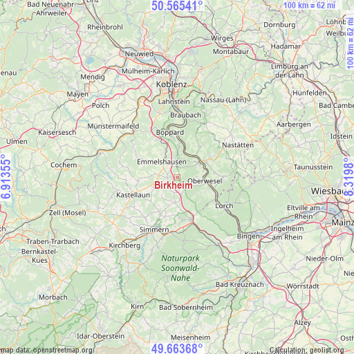
Birkheim GPS coordinates[2]
50° 7' 0.012" North, 7° 37' 0.012" East
| Map corner | latitude | longitude |
|---|---|---|
| Upper-left | 50.56541°, | 6.91355° |
| Center: | 50.11667°, | 7.61667° |
| Lower-right: | 49.66368°, | 8.3198° |
| Map W x H: | 100.3×100.3 km | = 62.3×62.3mi |
| max Lat: | 55.01917° ⇑61% North |
| Birkheim: | 50.11667° |
| min Lat: | ⇓39% South 47.40724° |
| min Long | Birkheim | max Long |
| 5.92978° | 7.61667° | 14.98853° |
| W 15.2%⇐ | ⇒84.8% E |
Elevation
Elevation of Birkheim is 452 m = 1483 ft, and this is 202.9 m = 666 ft above average elevation for this country.
| Max E: |
1256 m = 4121 ft | 17.2% |
| Birkheim | 452 m 1483 ft | |
| Avg. | 249.1 m = 817 ft | |
Min E: |
-5 m = -16 ft | 82.8% |
See also: Germany elevation on elevation.city.
Geographical zone
Birkheim is located in North temperate zone (between Tropic of Cancer and the Arctic Circle). Distance of this North polar circle is 1828.7 km =1136.3 mi to North.| Distance of | km | miles | from Birkheim |
|---|---|---|---|
| North Pole | 4434.6 | 2755.5 | to North |
| Arctic Circle | 1828.7 | 1136.3 | to North |
| Tropic Cancer | 2966.5 | 1843.3 | to South |
| Equator | 5572.5 | 3462.6 | to South |


Nearby cities:
15 places around Birkheim: (largest is in red/bold)
• Badenhard
1.2 km =0.7 mi,  90°
90°
• Damscheid
5.1 km =3.2 mi,  111°
111°
• Dörth
4.4 km =2.7 mi,  327°
327°
• Hausbay
4.2 km =2.6 mi,  255°
255°
• Hungenroth
2.2 km =1.4 mi, 327°
• Karbach
3.7 km =2.3 mi,  0°
0°
• Leiningen
4 km =2.5 mi,  297°
297°
• Lingerhahn
4.5 km =2.8 mi,  236°
236°
• Maisborn
4.6 km =2.9 mi,  213°
213°
• Mühlpfad
4.4 km =2.7 mi,  276°
276°
• Niederburg
5.9 km =3.7 mi, 90°
• Norath
3 km =1.9 mi,  307°
307°
• Pfalzfeld
2.8 km =1.7 mi, 259°
• Utzenhain
2.2 km =1.4 mi,  32°
32°
• Wiebelsheim
3.9 km =2.4 mi,  162°
162°
Sources, notices
• [Note1] Compared only with cities in Germany existing in our database
• [Src1] Map data: © OpenStreetMap contributors (CC-BY-SA)
• [Src2] Other city data from geonames.org with taken over terms of usage.
• [Src3] Geographical zone / Annual Mean Temperature by Robert A. Rohde @ Wikipedia
