Birkenhördt geodata
Birkenhördt (Rheinland-Pfalz) is a seat of a fourth-order administrative division; located in Germany in Europe/Berlin (GMT+2) time zone. With population of 653 people, there are 8539 cities with bigger population in this country. Compared to other cities in Germany, 81.5% of cities are located further ↑North; 78.5% of cities are located further →East and 54.9% of cities have lower elevation than Birkenhördt. Note1
Administrative division(s):
- Level 1: Rheinland-Pfalz
- Level 3: Landkreis Südliche Weinstraße
- Level 4: Birkenhördt


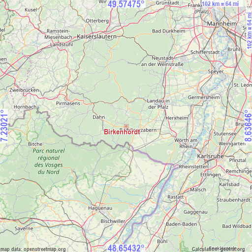
Birkenhördt GPS coordinates[2]
49° 7' 0.012" North, 7° 55' 59.988" East
| Map corner | latitude | longitude |
|---|---|---|
| Upper-left | 49.57475°, | 7.23021° |
| Center: | 49.11667°, | 7.93333° |
| Lower-right: | 48.65432°, | 8.63646° |
| Map W x H: | 102.3×102.3 km | = 63.6×63.6mi |
| max Lat: | 55.01917° ⇑81.5% North |
| Birkenhördt: | 49.11667° |
| min Lat: | ⇓18.5% South 47.40724° |
| min Long | Birkenhördt | max Long |
| 5.92978° | 7.93333° | 14.98853° |
| W 21.5%⇐ | ⇒78.5% E |
Elevation
Elevation of Birkenhördt is 257 m = 843 ft, and this is 7.9 m = 26 ft above average elevation for this country.
| Max E: |
1256 m = 4121 ft | 45.1% |
| Birkenhördt | 257 m 843 ft | |
| Avg. | 249.1 m = 817 ft | |
Min E: |
-5 m = -16 ft | 54.9% |
See also: Germany elevation on elevation.city.
Geographical zone
Birkenhördt is located in North temperate zone (between Tropic of Cancer and the Arctic Circle). Distance of this North polar circle is 1939.9 km =1205.4 mi to North.| Distance of | km | miles | from Birkenhördt |
|---|---|---|---|
| North Pole | 4545.8 | 2824.6 | to North |
| Arctic Circle | 1939.9 | 1205.4 | to North |
| Tropic Cancer | 2855.3 | 1774.2 | to South |
| Equator | 5461.3 | 3393.5 | to South |


Nearby cities:
15 places around Birkenhördt: (largest is in red/bold)
• Bad Bergzabern
5.2 km =3.2 mi,  107°
107°
• Böllenborn
1.9 km =1.2 mi,  180°
180°
• Darstein
5.2 km =3.2 mi,  315°
315°
• Dimbach
6.1 km =3.8 mi,  336°
336°
• Dörrenbach
3.6 km =2.2 mi,  145°
145°
• Gleiszellen-Gleishorbach
5.4 km =3.4 mi,  78°
78°
• Gossersweiler-Stein
3.7 km =2.3 mi,  0°
0°
• Münchweiler am Klingbach
4.4 km =2.7 mi,  33°
33°
• Oberotterbach
5.8 km =3.6 mi, 152°
• Oberschlettenbach
5.5 km =3.4 mi,  306°
306°
• Pleisweiler-Oberhofen
5.4 km =3.4 mi,  88°
88°
• Silz
3.9 km =2.4 mi,  18°
18°
• Vorderweidenthal
4.1 km =2.5 mi,  296°
296°
• Völkersweiler
5.6 km =3.5 mi, 0°
• Waldrohrbach
6.1 km =3.8 mi, 23°
Sources, notices
• [Note1] Compared only with cities in Germany existing in our database
• [Src1] Map data: © OpenStreetMap contributors (CC-BY-SA)
• [Src2] Other city data from geonames.org with taken over terms of usage.
• [Src3] Geographical zone / Annual Mean Temperature by Robert A. Rohde @ Wikipedia
