Bienstädt geodata
Bienstädt (Thuringia) is a seat of a fourth-order administrative division; located in Germany in Europe/Berlin (GMT+2) time zone. With population of 766 people, there are 8025 cities with bigger population in this country. Compared to other cities in Germany, 58.3% of cities are located further ↓South; 64.8% of cities are located further ←West and 68.9% of cities have lower elevation than Bienstädt. Note1


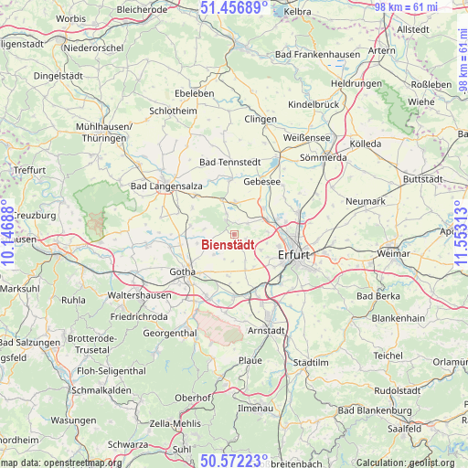
Bienstädt GPS coordinates[2]
51° 1' 0.012" North, 10° 51' 0" East
| Map corner | latitude | longitude |
|---|---|---|
| Upper-left | 51.45689°, | 10.14688° |
| Center: | 51.01667°, | 10.85° |
| Lower-right: | 50.57223°, | 11.55313° |
| Map W x H: | 98.4×98.4 km | = 61.1×61.1mi |
| max Lat: | 55.01917° ⇑41.7% North |
| Bienstädt: | 51.01667° |
| min Lat: | ⇓58.3% South 47.40724° |
| min Long | Bienstädt | max Long |
| 5.92978° | 10.85° | 14.98853° |
| W 64.8%⇐ | ⇒35.2% E |
Elevation
Elevation of Bienstädt is 350 m = 1148 ft, and this is 100.9 m = 331 ft above average elevation for this country.
| Max E: |
1256 m = 4121 ft | 31.1% |
| Bienstädt | 350 m 1148 ft | |
| Avg. | 249.1 m = 817 ft | |
Min E: |
-5 m = -16 ft | 68.9% |
See also: Germany elevation on elevation.city.
Geographical zone
Bienstädt is located in North temperate zone (between Tropic of Cancer and the Arctic Circle). Distance of this North polar circle is 1728.7 km =1074.2 mi to North.| Distance of | km | miles | from Bienstädt |
|---|---|---|---|
| North Pole | 4334.5 | 2693.3 | to North |
| Arctic Circle | 1728.7 | 1074.2 | to North |
| Tropic Cancer | 3066.6 | 1905.5 | to South |
| Equator | 5672.5 | 3524.7 | to South |


Nearby cities:
15 places around Bienstädt: (largest is in red/bold)
• Dachwig
6.8 km =4.2 mi,  2°
2°
• Döllstädt
7.8 km =4.8 mi,  342°
342°
• Elxleben
7.9 km =4.9 mi,  62°
62°
• Eschenbergen
6.4 km =4 mi,  280°
280°
• Friemar
6.2 km =3.9 mi,  224°
224°
• Gamstädt
7.9 km =4.9 mi,  161°
161°
• Gierstädt
3.3 km =2.1 mi,  329°
329°
• Großfahner
4.7 km =2.9 mi, 340°
• Molschleben
5 km =3.1 mi,  248°
248°
• Nottleben
5.6 km =3.5 mi,  180°
180°
• Pferdingsleben
6 km =3.7 mi,  202°
202°
• Tröchtelborn
3 km =1.9 mi,  231°
231°
• Walschleben
8.1 km =5 mi,  46°
46°
• Witterda
3.6 km =2.2 mi, 52°
• Zimmernsupra
3.9 km =2.4 mi, 162°
Sources, notices
• [Note1] Compared only with cities in Germany existing in our database
• [Src1] Map data: © OpenStreetMap contributors (CC-BY-SA)
• [Src2] Other city data from geonames.org with taken over terms of usage.
• [Src3] Geographical zone / Annual Mean Temperature by Robert A. Rohde @ Wikipedia
