Beendorf geodata
Beendorf (Saxony-Anhalt) is a seat of a fourth-order administrative division; located in Germany in Europe/Berlin (GMT+2) time zone. With population of 878 people, there are 7601 cities with bigger population in this country. Compared to other cities in Germany, 74.5% of cities are located further ↓South; 68.3% of cities are located further ←West and 65.2% of cities have higher elevation than Beendorf. Note1


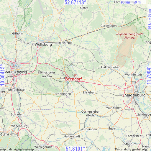
Beendorf GPS coordinates[2]
52° 14' 33.828" North, 11° 5' 14.172" East
| Map corner | latitude | longitude |
|---|---|---|
| Upper-left | 52.67118°, | 10.38415° |
| Center: | 52.24273°, | 11.08727° |
| Lower-right: | 51.8101°, | 11.7904° |
| Map W x H: | 95.7×95.7 km | = 59.5×59.5mi |
| max Lat: | 55.01917° ⇑25.5% North |
| Beendorf: | 52.24273° |
| min Lat: | ⇓74.5% South 47.40724° |
| min Long | Beendorf | max Long |
| 5.92978° | 11.08727° | 14.98853° |
| W 68.3%⇐ | ⇒31.7% E |
Elevation
Elevation of Beendorf is 119 m = 390 ft, and this is 130.1 m = 427 ft below average elevation for this country.
| Max E: |
1256 m = 4121 ft | 65.2% |
| Avg. | 249.1 m = 817 ft | |
| Beendorf | 119 m = 390 ft | |
Min E: |
-5 m = -16 ft | 34.8% |
See also: Germany elevation on elevation.city.
Geographical zone
Beendorf is located in North temperate zone (between Tropic of Cancer and the Arctic Circle). Distance of this North polar circle is 1592.3 km =989.4 mi to North.| Distance of | km | miles | from Beendorf |
|---|---|---|---|
| North Pole | 4198.2 | 2608.6 | to North |
| Arctic Circle | 1592.3 | 989.4 | to North |
| Tropic Cancer | 3202.9 | 1990.2 | to South |
| Equator | 5808.8 | 3609.4 | to South |


Nearby cities:
15 places around Beendorf: (largest is in red/bold)
• Behnsdorf
9.2 km =5.7 mi,  28°
28°
• Bregenstedt
9.3 km =5.8 mi,  82°
82°
• Büddenstedt
9.3 km =5.8 mi,  210°
210°
• Eimersleben
8.1 km =5 mi,  106°
106°
• Grasleben
8.6 km =5.3 mi,  325°
325°
• Harbke
6.6 km =4.1 mi,  204°
204°
• Helmstedt
5.5 km =3.4 mi,  252°
252°
• Hörsingen
6.1 km =3.8 mi,  48°
48°
• Marienborn
5.3 km =3.3 mi,  165°
165°
• Mariental
8 km =5 mi,  297°
297°
• Siestedt
8.4 km =5.2 mi,  2°
2°
• Sommersdorf
8.5 km =5.3 mi,  181°
181°
• Walbeck
4.3 km =2.7 mi,  339°
339°
• Wefensleben
8.3 km =5.2 mi,  142°
142°
• Weferlingen
8 km =5 mi,  345°
345°
Sources, notices
• [Note1] Compared only with cities in Germany existing in our database
• [Src1] Map data: © OpenStreetMap contributors (CC-BY-SA)
• [Src2] Other city data from geonames.org with taken over terms of usage.
• [Src3] Geographical zone / Annual Mean Temperature by Robert A. Rohde @ Wikipedia
