Barsbüttel geodata
Barsbüttel (Schleswig-Holstein) is a seat of a fourth-order administrative division; located in Germany in Europe/Berlin (GMT+2) time zone. With population of 12,363 people, there are 1318 cities with bigger population in this country. Compared to other cities in Germany, 86.4% of cities are located further ↓South; 52.7% of cities are located further ←West and 87.3% of cities have higher elevation than Barsbüttel. Note1


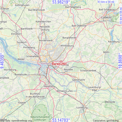
Barsbüttel GPS coordinates[2]
53° 34' 0.012" North, 10° 10' 0.012" East
| Map corner | latitude | longitude |
|---|---|---|
| Upper-left | 53.98219°, | 9.46355° |
| Center: | 53.56667°, | 10.16667° |
| Lower-right: | 53.14703°, | 10.8698° |
| Map W x H: | 92.9×92.9 km | = 57.7×57.7mi |
| max Lat: | 55.01917° ⇑13.6% North |
| Barsbüttel: | 53.56667° |
| min Lat: | ⇓86.4% South 47.40724° |
| min Long | Barsbüttel | max Long |
| 5.92978° | 10.16667° | 14.98853° |
| W 52.7%⇐ | ⇒47.3% E |
Elevation
Elevation of Barsbüttel is 29 m = 95 ft, and this is 220.1 m = 722 ft below average elevation for this country.
| Max E: |
1256 m = 4121 ft | 87.3% |
| Avg. | 249.1 m = 817 ft | |
| Barsbüttel | 29 m = 95 ft | |
Min E: |
-5 m = -16 ft | 12.7% |
See also: Germany elevation on elevation.city.
Geographical zone
Barsbüttel is located in North temperate zone (between Tropic of Cancer and the Arctic Circle). Distance of this North polar circle is 1445.1 km =897.9 mi to North.| Distance of | km | miles | from Barsbüttel |
|---|---|---|---|
| North Pole | 4051 | 2517.2 | to North |
| Arctic Circle | 1445.1 | 897.9 | to North |
| Tropic Cancer | 3350.1 | 2081.7 | to South |
| Equator | 5956.1 | 3700.9 | to South |


Nearby cities:
15 places around Barsbüttel: (largest is in red/bold)
• Barmbek-Nord
9.4 km =5.8 mi,  297°
297°
• Borgfelde
8.8 km =5.5 mi,  261°
261°
• Braak
7.1 km =4.4 mi,  47°
47°
• Farmsen-Berne
5.4 km =3.4 mi,  324°
324°
• Glinde
3.4 km =2.1 mi,  138°
138°
• Hammerbrook
9.3 km =5.8 mi, 255°
• Marienthal
5.5 km =3.4 mi,  270°
270°
• Oststeinbek
2.6 km =1.6 mi,  176°
176°
• Reinbek
7.7 km =4.8 mi, 135°
• Rothenburgsort
9 km =5.6 mi,  247°
247°
• Stapelfeld
5 km =3.1 mi,  41°
41°
• Steilshoop
8.6 km =5.3 mi, 304°
• Wandsbek
5.8 km =3.6 mi,  288°
288°
• Wentorf bei Hamburg
9.2 km =5.7 mi, 143°
• Wohltorf
9.5 km =5.9 mi,  125°
125°
Sources, notices
• [Note1] Compared only with cities in Germany existing in our database
• [Src1] Map data: © OpenStreetMap contributors (CC-BY-SA)
• [Src2] Other city data from geonames.org with taken over terms of usage.
• [Src3] Geographical zone / Annual Mean Temperature by Robert A. Rohde @ Wikipedia
