Alflen geodata
Alflen (Rheinland-Pfalz) is a seat of a fourth-order administrative division; located in Germany in Europe/Berlin (GMT+2) time zone. With population of 850 people, there are 7703 cities with bigger population in this country. Compared to other cities in Germany, 59.5% of cities are located further ↑North; 92.9% of cities are located further →East and 78.5% of cities have lower elevation than Alflen. Note1


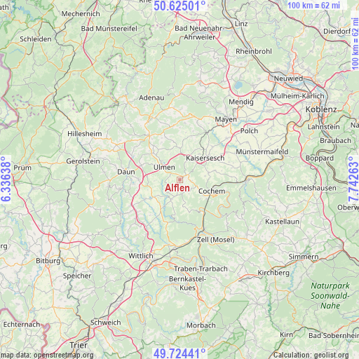
Alflen GPS coordinates[2]
50° 10' 36.588" North, 7° 2' 22.2" East
| Map corner | latitude | longitude |
|---|---|---|
| Upper-left | 50.62501°, | 6.33638° |
| Center: | 50.17683°, | 7.0395° |
| Lower-right: | 49.72441°, | 7.74263° |
| Map W x H: | 100.1×100.1 km | = 62.2×62.2mi |
| max Lat: | 55.01917° ⇑59.5% North |
| Alflen: | 50.17683° |
| min Lat: | ⇓40.5% South 47.40724° |
| min Long | Alflen | max Long |
| 5.92978° | 7.0395° | 14.98853° |
| W 7.1%⇐ | ⇒92.9% E |
Elevation
Elevation of Alflen is 423 m = 1388 ft, and this is 173.9 m = 571 ft above average elevation for this country.
| Max E: |
1256 m = 4121 ft | 21.5% |
| Alflen | 423 m 1388 ft | |
| Avg. | 249.1 m = 817 ft | |
Min E: |
-5 m = -16 ft | 78.5% |
See also: Germany elevation on elevation.city.
Geographical zone
Alflen is located in North temperate zone (between Tropic of Cancer and the Arctic Circle). Distance of this North polar circle is 1822 km =1132.1 mi to North.| Distance of | km | miles | from Alflen |
|---|---|---|---|
| North Pole | 4427.9 | 2751.4 | to North |
| Arctic Circle | 1822 | 1132.1 | to North |
| Tropic Cancer | 2973.2 | 1847.5 | to South |
| Equator | 5579.1 | 3466.7 | to South |


Nearby cities:
15 places around Alflen: (largest is in red/bold)
• Auderath
2.9 km =1.8 mi,  284°
284°
• Büchel
3.1 km =1.9 mi,  98°
98°
• Demerath
6.4 km =4 mi, 276°
• Filz
4.2 km =2.6 mi,  254°
254°
• Gevenich
4.3 km =2.7 mi,  133°
133°
• Gillenbeuren
2.8 km =1.7 mi,  211°
211°
• Laubach
6.7 km =4.2 mi,  21°
21°
• Leienkaul
5.4 km =3.4 mi,  35°
35°
• Lutzerath
6 km =3.7 mi,  202°
202°
• Müllenbach
5.3 km =3.3 mi, 20°
• Schmitt
2 km =1.2 mi,  235°
235°
• Ulmen
5.6 km =3.5 mi,  310°
310°
• Wagenhausen
5 km =3.1 mi,  233°
233°
• Weiler
4.3 km =2.7 mi, 133°
• Wollmerath
5 km =3.1 mi, 233°
Sources, notices
• [Note1] Compared only with cities in Germany existing in our database
• [Src1] Map data: © OpenStreetMap contributors (CC-BY-SA)
• [Src2] Other city data from geonames.org with taken over terms of usage.
• [Src3] Geographical zone / Annual Mean Temperature by Robert A. Rohde @ Wikipedia
