Büchel geodata
Büchel (Rheinland-Pfalz) is a seat of a fourth-order administrative division; located in Germany in Europe/Berlin (GMT+2) time zone. With population of 1,143 people, there are 6722 cities with bigger population in this country. Compared to other cities in Germany, 59.5% of cities are located further ↑North; 92.6% of cities are located further →East and 82.7% of cities have lower elevation than Büchel. Note1


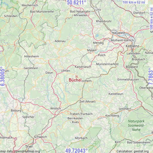
Büchel GPS coordinates[2]
50° 10' 22.404" North, 7° 4' 59.448" East
| Map corner | latitude | longitude |
|---|---|---|
| Upper-left | 50.6211°, | 6.38005° |
| Center: | 50.17289°, | 7.08318° |
| Lower-right: | 49.72043°, | 7.7863° |
| Map W x H: | 100.1×100.1 km | = 62.2×62.2mi |
| max Lat: | 55.01917° ⇑59.5% North |
| Büchel: | 50.17289° |
| min Lat: | ⇓40.5% South 47.40724° |
| min Long | Büchel | max Long |
| 5.92978° | 7.08318° | 14.98853° |
| W 7.4%⇐ | ⇒92.6% E |
Elevation
Elevation of Büchel is 451 m = 1480 ft, and this is 201.9 m = 662 ft above average elevation for this country.
| Max E: |
1256 m = 4121 ft | 17.3% |
| Büchel | 451 m 1480 ft | |
| Avg. | 249.1 m = 817 ft | |
Min E: |
-5 m = -16 ft | 82.7% |
See also: Germany elevation on elevation.city.
Geographical zone
Büchel is located in North temperate zone (between Tropic of Cancer and the Arctic Circle). Distance of this North polar circle is 1822.5 km =1132.4 mi to North.| Distance of | km | miles | from Büchel |
|---|---|---|---|
| North Pole | 4428.4 | 2751.7 | to North |
| Arctic Circle | 1822.5 | 1132.4 | to North |
| Tropic Cancer | 2972.8 | 1847.2 | to South |
| Equator | 5578.7 | 3466.4 | to South |


Nearby cities:
15 places around Büchel: (largest is in red/bold)
• Alflen
3.1 km =1.9 mi,  278°
278°
• Auderath
6 km =3.7 mi, 281°
• Cochem
6.5 km =4 mi,  118°
118°
• Dohr
5.6 km =3.5 mi,  150°
150°
• Faid
4.1 km =2.5 mi,  140°
140°
• Gevenich
2.5 km =1.6 mi,  179°
179°
• Gillenbeuren
5 km =3.1 mi,  246°
246°
• Greimersburg
3.8 km =2.4 mi,  71°
71°
• Kliding
6.7 km =4.2 mi,  200°
200°
• Landkern
5.5 km =3.4 mi, 65°
• Leienkaul
4.9 km =3 mi,  0°
0°
• Müllenbach
5.5 km =3.4 mi,  347°
347°
• Schmitt
4.8 km =3 mi,  261°
261°
• Urschmitt
6.4 km =4 mi,  190°
190°
• Weiler
2.5 km =1.6 mi, 179°
Sources, notices
• [Note1] Compared only with cities in Germany existing in our database
• [Src1] Map data: © OpenStreetMap contributors (CC-BY-SA)
• [Src2] Other city data from geonames.org with taken over terms of usage.
• [Src3] Geographical zone / Annual Mean Temperature by Robert A. Rohde @ Wikipedia
