Aholfing geodata
Aholfing (Bavaria) is a seat of a fourth-order administrative division; located in Germany in Europe/Berlin (GMT+2) time zone. With population of 1,735 people, there are 5451 cities with bigger population in this country. Compared to other cities in Germany, 83.6% of cities are located further ↑North; 87.7% of cities are located further ←West and 65.2% of cities have lower elevation than Aholfing. Note1
Administrative division(s):
- Level 1: Bavaria
- Level 2: Lower Bavaria
- Level 3: Landkreis Straubing-Bogen
- Level 4: Aholfing


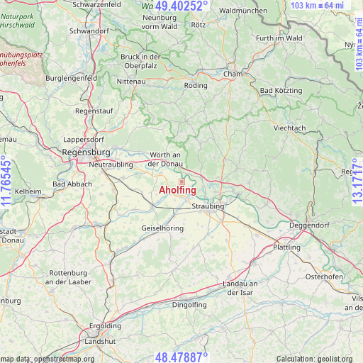
Aholfing GPS coordinates[2]
48° 56' 34.188" North, 12° 28' 6.852" East
| Map corner | latitude | longitude |
|---|---|---|
| Upper-left | 49.40252°, | 11.76545° |
| Center: | 48.94283°, | 12.46857° |
| Lower-right: | 48.47887°, | 13.1717° |
| Map W x H: | 102.7×102.7 km | = 63.8×63.8mi |
| max Lat: | 55.01917° ⇑83.6% North |
| Aholfing: | 48.94283° |
| min Lat: | ⇓16.4% South 47.40724° |
| min Long | Aholfing | max Long |
| 5.92978° | 12.46857° | 14.98853° |
| W 87.7%⇐ | ⇒12.3% E |
Elevation
Elevation of Aholfing is 323 m = 1060 ft, and this is 73.9 m = 242 ft above average elevation for this country.
| Max E: |
1256 m = 4121 ft | 34.8% |
| Aholfing | 323 m 1060 ft | |
| Avg. | 249.1 m = 817 ft | |
Min E: |
-5 m = -16 ft | 65.2% |
See also: Germany elevation on elevation.city.
Geographical zone
Aholfing is located in North temperate zone (between Tropic of Cancer and the Arctic Circle). Distance of this North polar circle is 1959.2 km =1217.4 mi to North.| Distance of | km | miles | from Aholfing |
|---|---|---|---|
| North Pole | 4565.1 | 2836.6 | to North |
| Arctic Circle | 1959.2 | 1217.4 | to North |
| Tropic Cancer | 2836 | 1762.2 | to South |
| Equator | 5441.9 | 3381.4 | to South |


Nearby cities:
15 places around Aholfing: (largest is in red/bold)
• Atting
5.6 km =3.5 mi,  165°
165°
• Falkenfels
11.5 km =7.1 mi,  53°
53°
• Kirchroth
6 km =3.7 mi,  82°
82°
• Mötzing
8.8 km =5.5 mi,  231°
231°
• Parkstetten
10 km =6.2 mi,  106°
106°
• Perkam
10 km =6.2 mi,  192°
192°
• Pfatter
6.7 km =4.2 mi,  289°
289°
• Rain
4.2 km =2.6 mi,  179°
179°
• Riekofen
9.1 km =5.7 mi,  251°
251°
• Steinach
10.2 km =6.3 mi, 82°
• Straubing
10.3 km =6.4 mi,  131°
131°
• Sünching
11.2 km =7 mi, 230°
• Wiesenfelden
12.1 km =7.5 mi,  25°
25°
• Wiesent
10.3 km =6.4 mi,  322°
322°
• Wörth an der Donau
7.9 km =4.9 mi, 324°
Sources, notices
• [Note1] Compared only with cities in Germany existing in our database
• [Src1] Map data: © OpenStreetMap contributors (CC-BY-SA)
• [Src2] Other city data from geonames.org with taken over terms of usage.
• [Src3] Geographical zone / Annual Mean Temperature by Robert A. Rohde @ Wikipedia
