Abtweiler geodata
Abtweiler (Rheinland-Pfalz) is a seat of a fourth-order administrative division; located in Germany in Europe/Berlin (GMT+2) time zone. With population of 256 people, there are 10232 cities with bigger population in this country. Compared to other cities in Germany, 70.2% of cities are located further ↑North; 84% of cities are located further →East and 59.1% of cities have lower elevation than Abtweiler. Note1
Administrative division(s):
- Level 1: Rheinland-Pfalz
- Level 3: Landkreis Bad Kreuznach
- Level 4: Abtweiler


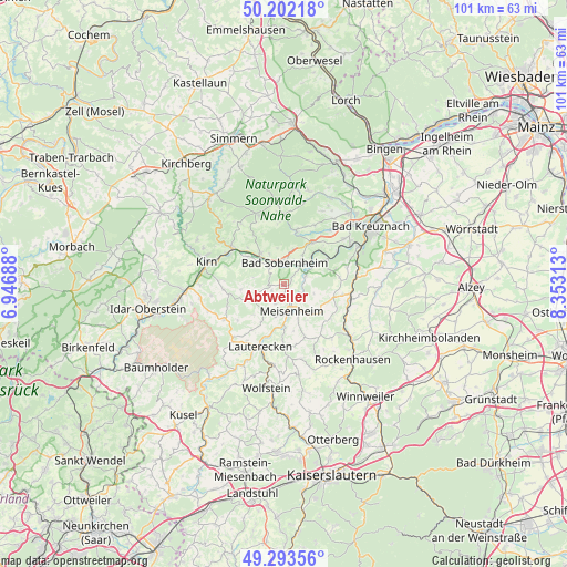
Abtweiler GPS coordinates[2]
49° 45' 0" North, 7° 39' 0" East
| Map corner | latitude | longitude |
|---|---|---|
| Upper-left | 50.20218°, | 6.94688° |
| Center: | 49.75°, | 7.65° |
| Lower-right: | 49.29356°, | 8.35313° |
| Map W x H: | 101×101 km | = 62.8×62.8mi |
| max Lat: | 55.01917° ⇑70.2% North |
| Abtweiler: | 49.75° |
| min Lat: | ⇓29.8% South 47.40724° |
| min Long | Abtweiler | max Long |
| 5.92978° | 7.65° | 14.98853° |
| W 16%⇐ | ⇒84% E |
Elevation
Elevation of Abtweiler is 284 m = 932 ft, and this is 34.9 m = 115 ft above average elevation for this country.
| Max E: |
1256 m = 4121 ft | 40.9% |
| Abtweiler | 284 m 932 ft | |
| Avg. | 249.1 m = 817 ft | |
Min E: |
-5 m = -16 ft | 59.1% |
See also: Germany elevation on elevation.city.
Geographical zone
Abtweiler is located in North temperate zone (between Tropic of Cancer and the Arctic Circle). Distance of this North polar circle is 1869.5 km =1161.7 mi to North.| Distance of | km | miles | from Abtweiler |
|---|---|---|---|
| North Pole | 4475.4 | 2780.9 | to North |
| Arctic Circle | 1869.5 | 1161.7 | to North |
| Tropic Cancer | 2925.8 | 1818 | to South |
| Equator | 5531.7 | 3437.2 | to South |


Nearby cities:
15 places around Abtweiler: (largest is in red/bold)
• Breitenheim
5.7 km =3.5 mi,  192°
192°
• Bärweiler
4 km =2.5 mi,  242°
242°
• Desloch
3.9 km =2.4 mi,  197°
197°
• Jeckenbach
5.2 km =3.2 mi,  224°
224°
• Kirschroth
6.3 km =3.9 mi,  287°
287°
• Lauschied
3 km =1.9 mi,  232°
232°
• Lettweiler
6.3 km =3.9 mi,  107°
107°
• Meddersheim
3.8 km =2.4 mi,  321°
321°
• Meisenheim
4.9 km =3 mi,  165°
165°
• Nußbaum
6.1 km =3.8 mi,  336°
336°
• Oberstreit
6.6 km =4.1 mi,  32°
32°
• Odernheim
4.2 km =2.6 mi,  66°
66°
• Raumbach
3.7 km =2.3 mi,  180°
180°
• Rehborn
3 km =1.9 mi,  127°
127°
• Staudernheim
4.1 km =2.5 mi,  43°
43°
Sources, notices
• [Note1] Compared only with cities in Germany existing in our database
• [Src1] Map data: © OpenStreetMap contributors (CC-BY-SA)
• [Src2] Other city data from geonames.org with taken over terms of usage.
• [Src3] Geographical zone / Annual Mean Temperature by Robert A. Rohde @ Wikipedia
