Hoppstädten-Weiersbach geodata
Hoppstädten-Weiersbach (Rheinland-Pfalz) is a seat of a fourth-order administrative division; located in Germany in Europe/Berlin (GMT+2) time zone. With population of 2,749 people, there are 4195 cities with bigger population in this country. Compared to other cities in Germany, 73.5% of cities are located further ↑North; 91.4% of cities are located further →East and 67.1% of cities have lower elevation than Hoppstädten-Weiersbach. Note1
Administrative division(s):
- Level 1: Rheinland-Pfalz
- Level 3: Landkreis Birkenfeld
- Level 4: Hoppstädten-Weiersbach
Current local time in Hoppstädten-Weiersbach:
06:10 PM, TuesdayDifference from your time zone: hours


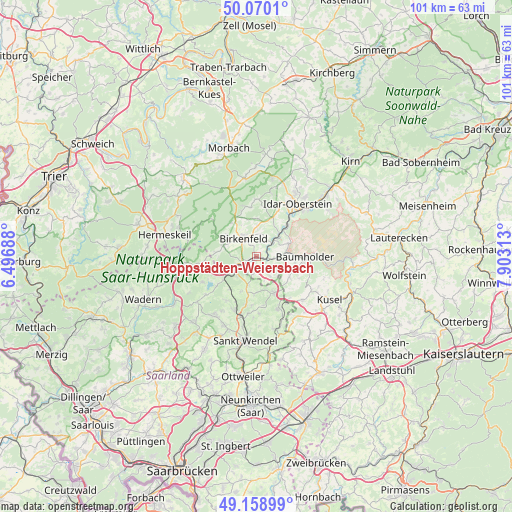
Hoppstädten-Weiersbach GPS coordinates[2]
49° 37' 0.012" North, 7° 12' 0" East
| Map corner | latitude | longitude |
|---|---|---|
| Upper-left | 50.0701°, | 6.49688° |
| Center: | 49.61667°, | 7.2° |
| Lower-right: | 49.15899°, | 7.90313° |
| Map W x H: | 101.3×101.3 km | = 62.9×62.9mi |
| max Lat: | 55.01917° ⇑73.5% North |
| Hoppstädten-Weiersbach: | 49.61667° |
| min Lat: | ⇓26.5% South 47.40724° |
| min Long | Hoppstädten-We | max Long |
| 5.92978° | 7.2° | 14.98853° |
| W 8.6%⇐ | ⇒91.4% E |
Elevation
Elevation of Hoppstädten-Weiersbach is 336 m = 1102 ft, and this is 86.9 m = 285 ft above average elevation for this country.
| Max E: |
1256 m = 4121 ft | 32.9% |
| Hoppstädten-Weiersbach | 336 m 1102 ft | |
| Avg. | 249.1 m = 817 ft | |
Min E: |
-5 m = -16 ft | 67.1% |
See also: Germany elevation on elevation.city.
Geographical zone
Hoppstädten-Weiersbach is located in North temperate zone (between Tropic of Cancer and the Arctic Circle). Distance of this North polar circle is 1884.3 km =1170.8 mi to North.| Distance of | km | miles | from Hoppstädten-Weiersbach |
|---|---|---|---|
| North Pole | 4490.2 | 2790.1 | to North |
| Arctic Circle | 1884.3 | 1170.8 | to North |
| Tropic Cancer | 2910.9 | 1808.7 | to South |
| Equator | 5516.9 | 3428 | to South |


Nearby cities:
15 places around Hoppstädten-Weiersbach: (largest is in red/bold)
• Berglangenbach
4.1 km =2.5 mi,  117°
117°
• Birkenfeld
4.6 km =2.9 mi,  328°
328°
• Dambach
5.1 km =3.2 mi,  291°
291°
• Dienstweiler
2.2 km =1.4 mi, 327°
• Elchweiler
5.6 km =3.5 mi,  0°
0°
• Ellenberg
5.2 km =3.2 mi,  315°
315°
• Ellweiler
3.6 km =2.2 mi,  270°
270°
• Gimbweiler
3.7 km =2.3 mi,  180°
180°
• Heimbach
3.6 km =2.2 mi,  90°
90°
• Leitzweiler
3.9 km =2.4 mi,  162°
162°
• Nohen
4 km =2.5 mi,  62°
62°
• Nohfelden
5.3 km =3.3 mi,  231°
231°
• Rimsberg
3.9 km =2.4 mi,  17°
17°
• Rückweiler
4.4 km =2.7 mi,  147°
147°
• Schmißberg
5.6 km =3.5 mi, 0°
Sources, notices
• [Note1] Compared only with cities in Germany existing in our database
• [Src1] Map data: © OpenStreetMap contributors (CC-BY-SA)
• [Src2] Other city data from geonames.org with taken over terms of usage.
• [Src3] Geographical zone / Annual Mean Temperature by Robert A. Rohde @ Wikipedia
