Leitzweiler geodata
Leitzweiler (Rheinland-Pfalz) is a seat of a fourth-order administrative division; located in Germany in Europe/Berlin (GMT+2) time zone. With population of 127 people, there are 10772 cities with bigger population in this country. Compared to other cities in Germany, 74.2% of cities are located further ↑North; 91.2% of cities are located further →East and 90.6% of cities have lower elevation than Leitzweiler. Note1
Administrative division(s):
- Level 1: Rheinland-Pfalz
- Level 3: Landkreis Birkenfeld
- Level 4: Leitzweiler


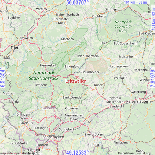
Leitzweiler GPS coordinates[2]
49° 34' 59.988" North, 7° 13' 0.012" East
| Map corner | latitude | longitude |
|---|---|---|
| Upper-left | 50.03707°, | 6.51354° |
| Center: | 49.58333°, | 7.21667° |
| Lower-right: | 49.12533°, | 7.91979° |
| Map W x H: | 101.4×101.4 km | = 63×63mi |
| max Lat: | 55.01917° ⇑74.2% North |
| Leitzweiler: | 49.58333° |
| min Lat: | ⇓25.8% South 47.40724° |
| min Long | Leitzweiler | max Long |
| 5.92978° | 7.21667° | 14.98853° |
| W 8.8%⇐ | ⇒91.2% E |
Elevation
Elevation of Leitzweiler is 521 m = 1709 ft, and this is 271.9 m = 892 ft above average elevation for this country.
| Max E: |
1256 m = 4121 ft | 9.4% |
| Leitzweiler | 521 m 1709 ft | |
| Avg. | 249.1 m = 817 ft | |
Min E: |
-5 m = -16 ft | 90.6% |
See also: Germany elevation on elevation.city.
Geographical zone
Leitzweiler is located in North temperate zone (between Tropic of Cancer and the Arctic Circle). Distance of this North polar circle is 1888 km =1173.1 mi to North.| Distance of | km | miles | from Leitzweiler |
|---|---|---|---|
| North Pole | 4493.9 | 2792.4 | to North |
| Arctic Circle | 1888 | 1173.1 | to North |
| Tropic Cancer | 2907.2 | 1806.4 | to South |
| Equator | 5513.1 | 3425.7 | to South |


Nearby cities:
15 places around Leitzweiler: (largest is in red/bold)
• Berglangenbach
3 km =1.9 mi,  52°
52°
• Dienstweiler
6.1 km =3.8 mi,  336°
336°
• Eckersweiler
5.2 km =3.2 mi,  111°
111°
• Ellweiler
6.1 km =3.8 mi,  307°
307°
• Fohren-Linden
4.8 km =3 mi,  90°
90°
• Freisen
4.4 km =2.7 mi,  147°
147°
• Gimbweiler
1.2 km =0.7 mi,  270°
270°
• Hahnweiler
1.9 km =1.2 mi,  180°
180°
• Heimbach
4.4 km =2.7 mi,  32°
32°
• Hoppstädten-Weiersbach
3.9 km =2.4 mi, 342°
• Nohen
6.1 km =3.8 mi,  23°
23°
• Nohfelden
5.3 km =3.3 mi, 274°
• Rohrbach
3.6 km =2.2 mi, 90°
• Ruschberg
6.6 km =4.1 mi, 52°
• Rückweiler
1.2 km =0.7 mi, 90°
Sources, notices
• [Note1] Compared only with cities in Germany existing in our database
• [Src1] Map data: © OpenStreetMap contributors (CC-BY-SA)
• [Src2] Other city data from geonames.org with taken over terms of usage.
• [Src3] Geographical zone / Annual Mean Temperature by Robert A. Rohde @ Wikipedia
