Kell am See geodata
Kell am See (Rheinland-Pfalz) is a seat of a fourth-order administrative division; located in Germany in Europe/Berlin (GMT+2) time zone. In our database, there are 11009 cities with bigger population. Compared to other cities in Germany, 73% of cities are located further ↑North; 95.4% of cities are located further →East and 84.7% of cities have lower elevation than Kell am See. Note1
Administrative division(s):
- Level 1: Rheinland-Pfalz
- Level 3: Landkreis Trier-Saarburg
- Level 4: Kell am See


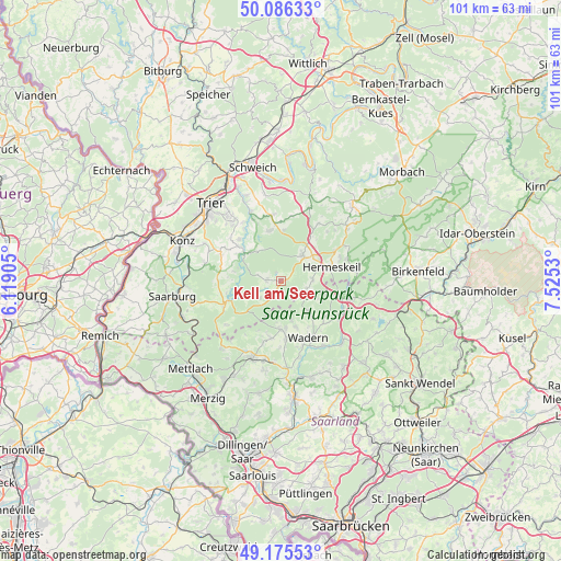
Kell am See GPS coordinates[2]
49° 37' 59.016" North, 6° 49' 19.812" East
| Map corner | latitude | longitude |
|---|---|---|
| Upper-left | 50.08633°, | 6.11905° |
| Center: | 49.63306°, | 6.82217° |
| Lower-right: | 49.17553°, | 7.5253° |
| Map W x H: | 101.3×101.3 km | = 62.9×62.9mi |
| max Lat: | 55.01917° ⇑73% North |
| Kell am See: | 49.63306° |
| min Lat: | ⇓27% South 47.40724° |
| min Long | Kell am See | max Long |
| 5.92978° | 6.82217° | 14.98853° |
| W 4.6%⇐ | ⇒95.4% E |
Elevation
Elevation of Kell am See is 466 m = 1529 ft, and this is 216.9 m = 712 ft above average elevation for this country.
| Max E: |
1256 m = 4121 ft | 15.3% |
| Kell am See | 466 m 1529 ft | |
| Avg. | 249.1 m = 817 ft | |
Min E: |
-5 m = -16 ft | 84.7% |
See also: Germany elevation on elevation.city.
Geographical zone
Kell am See is located in North temperate zone (between Tropic of Cancer and the Arctic Circle). Distance of this North polar circle is 1882.5 km =1169.7 mi to North.| Distance of | km | miles | from Kell am See |
|---|---|---|---|
| North Pole | 4488.4 | 2789 | to North |
| Arctic Circle | 1882.5 | 1169.7 | to North |
| Tropic Cancer | 2912.8 | 1809.9 | to South |
| Equator | 5518.7 | 3429.2 | to South |


Nearby cities:
15 places around Kell am See: (largest is in red/bold)
• Grimburg
4.8 km =3 mi,  112°
112°
• Gusenburg
5.6 km =3.5 mi,  89°
89°
• Heddert
5.5 km =3.4 mi,  289°
289°
• Hentern
9 km =5.6 mi,  258°
258°
• Hermeskeil
9.1 km =5.7 mi,  74°
74°
• Hinzenburg
7.4 km =4.6 mi,  300°
300°
• Holzerath
6.8 km =4.2 mi,  319°
319°
• Kell
0.2 km =0.1 mi,  43°
43°
• Lampaden
9 km =5.6 mi,  282°
282°
• Mandern
5.4 km =3.4 mi,  227°
227°
• Ollmuth
8.5 km =5.3 mi, 296°
• Reinsfeld
7.1 km =4.4 mi, 38°
• Schillingen
2.8 km =1.7 mi,  270°
270°
• Schömerich
8.8 km =5.5 mi, 270°
• Waldweiler
2.4 km =1.5 mi,  221°
221°
Sources, notices
• [Note1] Compared only with cities in Germany existing in our database
• [Src1] Map data: © OpenStreetMap contributors (CC-BY-SA)
• [Src2] Other city data from geonames.org with taken over terms of usage.
• [Src3] Geographical zone / Annual Mean Temperature by Robert A. Rohde @ Wikipedia
