Kell geodata
Kell (Rheinland-Pfalz) is a populated place; located in Germany in Europe/Berlin (GMT+2) time zone. With population of 1,953 people, there are 5132 cities with bigger population in this country. Compared to other cities in Germany, 72.8% of cities are located further ↑North; 95.3% of cities are located further →East and 84.8% of cities have lower elevation than Kell. Note1
Administrative division(s):
- Level 1: Rheinland-Pfalz
- Level 3: Landkreis Trier-Saarburg
- Level 4: Kell am See


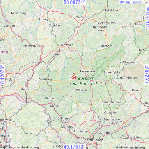
Kell GPS coordinates[2]
49° 38' 3.3" North, 6° 49' 26.04" East
| Map corner | latitude | longitude |
|---|---|---|
| Upper-left | 50.08751°, | 6.12078° |
| Center: | 49.63425°, | 6.8239° |
| Lower-right: | 49.17673°, | 7.52703° |
| Map W x H: | 101.3×101.3 km | = 62.9×62.9mi |
| max Lat: | 55.01917° ⇑72.8% North |
| Kell: | 49.63425° |
| min Lat: | ⇓27.2% South 47.40724° |
| min Long | Kell | max Long |
| 5.92978° | 6.8239° | 14.98853° |
| W 4.7%⇐ | ⇒95.3% E |
Elevation
Elevation of Kell is 467 m = 1532 ft, and this is 217.9 m = 715 ft above average elevation for this country.
| Max E: |
1256 m = 4121 ft | 15.2% |
| Kell | 467 m 1532 ft | |
| Avg. | 249.1 m = 817 ft | |
Min E: |
-5 m = -16 ft | 84.8% |
See also: Germany elevation on elevation.city.
Geographical zone
Kell is located in North temperate zone (between Tropic of Cancer and the Arctic Circle). Distance of this North polar circle is 1882.4 km =1169.7 mi to North.| Distance of | km | miles | from Kell |
|---|---|---|---|
| North Pole | 4488.3 | 2788.9 | to North |
| Arctic Circle | 1882.4 | 1169.7 | to North |
| Tropic Cancer | 2912.9 | 1810 | to South |
| Equator | 5518.8 | 3429.2 | to South |


Nearby cities:
15 places around Kell: (largest is in red/bold)
• Grimburg
4.7 km =2.9 mi,  114°
114°
• Gusenburg
5.5 km =3.4 mi,  91°
91°
• Heddert
5.6 km =3.5 mi,  288°
288°
• Hentern
9.1 km =5.7 mi,  257°
257°
• Hermeskeil
9 km =5.6 mi,  74°
74°
• Hinzenburg
7.5 km =4.7 mi,  298°
298°
• Hinzert-Pölert
9.1 km =5.7 mi,  36°
36°
• Holzerath
6.8 km =4.2 mi,  317°
317°
• Kell am See
0.2 km =0.1 mi,  223°
223°
• Mandern
5.6 km =3.5 mi,  227°
227°
• Ollmuth
8.5 km =5.3 mi, 295°
• Reinsfeld
6.9 km =4.3 mi, 38°
• Schillingen
2.9 km =1.8 mi,  267°
267°
• Schömerich
8.9 km =5.5 mi, 269°
• Waldweiler
2.6 km =1.6 mi, 221°
Sources, notices
• [Note1] Compared only with cities in Germany existing in our database
• [Src1] Map data: © OpenStreetMap contributors (CC-BY-SA)
• [Src2] Other city data from geonames.org with taken over terms of usage.
• [Src3] Geographical zone / Annual Mean Temperature by Robert A. Rohde @ Wikipedia
