Wittenberg geodata
Wittenberg (Saxony-Anhalt) is a seat of a third-order administrative division; located in Germany in Europe/Berlin (GMT+2) time zone. With population of 30,000 people, there are 466 cities with bigger population in this country. Compared to other cities in Germany, 70.6% of cities are located further ↓South; 89.3% of cities are located further ←West and 73% of cities have higher elevation than Wittenberg. Note1
Administrative division(s):
- Level 1: Saxony-Anhalt
- Level 3: Landkreis Wittenberg
- Level 4: Wittenberg, Lutherstadt


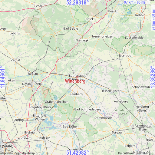
Wittenberg GPS coordinates[2]
51° 51' 57.96" North, 12° 38' 59.028" East
| Map corner | latitude | longitude |
|---|---|---|
| Upper-left | 52.29819°, | 11.94661° |
| Center: | 51.8661°, | 12.64973° |
| Lower-right: | 51.42982°, | 13.35286° |
| Map W x H: | 96.6×96.6 km | = 60×60mi |
| max Lat: | 55.01917° ⇑29.4% North |
| Wittenberg: | 51.8661° |
| min Lat: | ⇓70.6% South 47.40724° |
| min Long | Wittenberg | max Long |
| 5.92978° | 12.64973° | 14.98853° |
| W 89.3%⇐ | ⇒10.7% E |
Elevation
Elevation of Wittenberg is 72 m = 236 ft, and this is 177.1 m = 581 ft below average elevation for this country.
| Max E: |
1256 m = 4121 ft | 73% |
| Avg. | 249.1 m = 817 ft | |
| Wittenberg | 72 m = 236 ft | |
Min E: |
-5 m = -16 ft | 27% |
See also: Germany elevation on elevation.city.
Geographical zone
Wittenberg is located in North temperate zone (between Tropic of Cancer and the Arctic Circle). Distance of this North polar circle is 1634.2 km =1015.4 mi to North.| Distance of | km | miles | from Wittenberg |
|---|---|---|---|
| North Pole | 4240.1 | 2634.7 | to North |
| Arctic Circle | 1634.2 | 1015.4 | to North |
| Tropic Cancer | 3161.1 | 1964.2 | to South |
| Equator | 5767 | 3583.4 | to South |


Nearby cities:
15 places around Wittenberg: (largest is in red/bold)
• Abtsdorf
5.8 km =3.6 mi,  63°
63°
• Apollensdorf
6.9 km =4.3 mi,  279°
279°
• Apollensdorf-Nord
6 km =3.7 mi,  295°
295°
• Dabrun
5.5 km =3.4 mi,  131°
131°
• Dobien
5.1 km =3.2 mi,  328°
328°
• Elstervorstadt
2.8 km =1.7 mi,  93°
93°
• Eutzsch
5.2 km =3.2 mi,  189°
189°
• Friedrichstadt
2.7 km =1.7 mi,  29°
29°
• Kleinwittenberg
2.4 km =1.5 mi,  270°
270°
• Mühlanger
7.1 km =4.4 mi,  104°
104°
• Piesteritz
3.5 km =2.2 mi, 276°
• Pratau
2.7 km =1.7 mi, 188°
• Reinsdorf
4.4 km =2.7 mi,  314°
314°
• Rothemark
2.8 km =1.7 mi, 307°
• Teuchel
2.5 km =1.6 mi,  353°
353°
Sources, notices
• [Note1] Compared only with cities in Germany existing in our database
• [Src1] Map data: © OpenStreetMap contributors (CC-BY-SA)
• [Src2] Other city data from geonames.org with taken over terms of usage.
• [Src3] Geographical zone / Annual Mean Temperature by Robert A. Rohde @ Wikipedia
