Elstervorstadt geodata
Elstervorstadt (Saxony-Anhalt) is a populated place; located in Germany in Europe/Berlin (GMT+2) time zone. With population of 890 people, there are 7560 cities with bigger population in this country. Compared to other cities in Germany, 70.6% of cities are located further ↓South; 89.7% of cities are located further ←West and 73% of cities have higher elevation than Elstervorstadt. Note1
Administrative division(s):
- Level 1: Saxony-Anhalt
- Level 3: Landkreis Wittenberg
- Level 4: Wittenberg, Lutherstadt


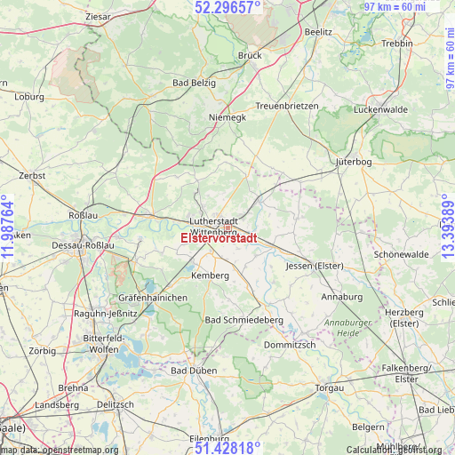
Elstervorstadt GPS coordinates[2]
51° 51' 52.092" North, 12° 41' 26.736" East
| Map corner | latitude | longitude |
|---|---|---|
| Upper-left | 52.29657°, | 11.98764° |
| Center: | 51.86447°, | 12.69076° |
| Lower-right: | 51.42818°, | 13.39389° |
| Map W x H: | 96.6×96.6 km | = 60×60mi |
| max Lat: | 55.01917° ⇑29.4% North |
| Elstervorstadt: | 51.86447° |
| min Lat: | ⇓70.6% South 47.40724° |
| min Long | Elstervorstadt | max Long |
| 5.92978° | 12.69076° | 14.98853° |
| W 89.7%⇐ | ⇒10.3% E |
Elevation
Elevation of Elstervorstadt is 72 m = 236 ft, and this is 177.1 m = 581 ft below average elevation for this country.
| Max E: |
1256 m = 4121 ft | 73% |
| Avg. | 249.1 m = 817 ft | |
| Elstervorstadt | 72 m = 236 ft | |
Min E: |
-5 m = -16 ft | 27% |
See also: Germany elevation on elevation.city.
Geographical zone
Elstervorstadt is located in North temperate zone (between Tropic of Cancer and the Arctic Circle). Distance of this North polar circle is 1634.4 km =1015.6 mi to North.| Distance of | km | miles | from Elstervorstadt |
|---|---|---|---|
| North Pole | 4240.3 | 2634.8 | to North |
| Arctic Circle | 1634.4 | 1015.6 | to North |
| Tropic Cancer | 3160.9 | 1964.1 | to South |
| Equator | 5766.8 | 3583.3 | to South |


Nearby cities:
15 places around Elstervorstadt: (largest is in red/bold)
• Abtsdorf
3.7 km =2.3 mi,  40°
40°
• Bülzig
5.5 km =3.4 mi,  53°
53°
• Dabrun
3.7 km =2.3 mi,  159°
159°
• Eutzsch
6.1 km =3.8 mi,  216°
216°
• Friedrichstadt
2.9 km =1.8 mi,  330°
330°
• Kleinwittenberg
5.2 km =3.2 mi,  272°
272°
• Mühlanger
4.4 km =2.7 mi,  111°
111°
• Piesteritz
6.4 km =4 mi,  275°
275°
• Pratau
4.1 km =2.5 mi,  232°
232°
• Rackith
6.8 km =4.2 mi,  182°
182°
• Reinsdorf
6.8 km =4.2 mi,  298°
298°
• Rothemark
5.4 km =3.4 mi,  290°
290°
• Teuchel
4.1 km =2.5 mi,  310°
310°
• Wittenberg
2.8 km =1.7 mi, 273°
• Zörnigall
4.5 km =2.8 mi,  82°
82°
Sources, notices
• [Note1] Compared only with cities in Germany existing in our database
• [Src1] Map data: © OpenStreetMap contributors (CC-BY-SA)
• [Src2] Other city data from geonames.org with taken over terms of usage.
• [Src3] Geographical zone / Annual Mean Temperature by Robert A. Rohde @ Wikipedia
