Lenningen geodata
Lenningen (Baden-Württemberg) is a seat of a fourth-order administrative division; located in Germany in Europe/Berlin (GMT+2) time zone. With population of 7,955 people, there are 1964 cities with bigger population in this country. Compared to other cities in Germany, 88.5% of cities are located further ↑North; 58.1% of cities are located further →East and 84.7% of cities have lower elevation than Lenningen. Note1
Administrative division(s):
- Level 1: Baden-Württemberg
- Level 2: Regierungsbezirk Stuttgart
- Level 3: Landkreis Esslingen
- Level 4: Lenningen


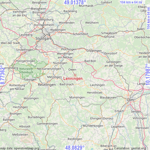
Lenningen GPS coordinates[2]
48° 33' 1.728" North, 9° 28' 36.264" East
| Map corner | latitude | longitude |
|---|---|---|
| Upper-left | 49.01378°, | 8.77362° |
| Center: | 48.55048°, | 9.47674° |
| Lower-right: | 48.0829°, | 10.17987° |
| Map W x H: | 103.5×103.5 km | = 64.3×64.3mi |
| max Lat: | 55.01917° ⇑88.5% North |
| Lenningen: | 48.55048° |
| min Lat: | ⇓11.5% South 47.40724° |
| min Long | Lenningen | max Long |
| 5.92978° | 9.47674° | 14.98853° |
| W 41.9%⇐ | ⇒58.1% E |
Elevation
Elevation of Lenningen is 466 m = 1529 ft, and this is 216.9 m = 712 ft above average elevation for this country.
| Max E: |
1256 m = 4121 ft | 15.3% |
| Lenningen | 466 m 1529 ft | |
| Avg. | 249.1 m = 817 ft | |
Min E: |
-5 m = -16 ft | 84.7% |
See also: Germany elevation on elevation.city.
Geographical zone
Lenningen is located in North temperate zone (between Tropic of Cancer and the Arctic Circle). Distance of this North polar circle is 2002.9 km =1244.5 mi to North.| Distance of | km | miles | from Lenningen |
|---|---|---|---|
| North Pole | 4608.8 | 2863.8 | to North |
| Arctic Circle | 2002.9 | 1244.5 | to North |
| Tropic Cancer | 2792.4 | 1735.1 | to South |
| Equator | 5398.3 | 3354.3 | to South |


Nearby cities:
15 places around Lenningen: (largest is in red/bold)
• Bad Urach
8.7 km =5.4 mi,  220°
220°
• Beuren
5.7 km =3.5 mi,  291°
291°
• Bissingen an der Teck
5.5 km =3.4 mi,  11°
11°
• Dettingen an der Erms
10 km =6.2 mi,  257°
257°
• Dettingen unter Teck
7.6 km =4.7 mi,  345°
345°
• Erkenbrechtsweiler
3.4 km =2.1 mi,  281°
281°
• Frickenhausen
9.8 km =6.1 mi,  299°
299°
• Grabenstetten
3.2 km =2 mi,  200°
200°
• Holzmaden
9.7 km =6 mi,  17°
17°
• Hülben
6.1 km =3.8 mi,  236°
236°
• Kohlberg
10.4 km =6.5 mi,  274°
274°
• Neidlingen
7.2 km =4.5 mi,  64°
64°
• Neuffen
7.5 km =4.7 mi, 273°
• Owen
4.6 km =2.9 mi,  334°
334°
• Weilheim an der Teck
8.5 km =5.3 mi,  31°
31°
Sources, notices
• [Note1] Compared only with cities in Germany existing in our database
• [Src1] Map data: © OpenStreetMap contributors (CC-BY-SA)
• [Src2] Other city data from geonames.org with taken over terms of usage.
• [Src3] Geographical zone / Annual Mean Temperature by Robert A. Rohde @ Wikipedia
