Neuffen geodata
Neuffen (Baden-Württemberg) is a populated place; located in Germany in Europe/Berlin (GMT+2) time zone. With population of 6,365 people, there are 2346 cities with bigger population in this country. Compared to other cities in Germany, 88.4% of cities are located further ↑North; 59.7% of cities are located further →East and 75.8% of cities have lower elevation than Neuffen. Note1
Administrative division(s):
- Level 1: Baden-Württemberg
- Level 2: Regierungsbezirk Stuttgart
- Level 3: Landkreis Esslingen
- Level 4: Neuffen


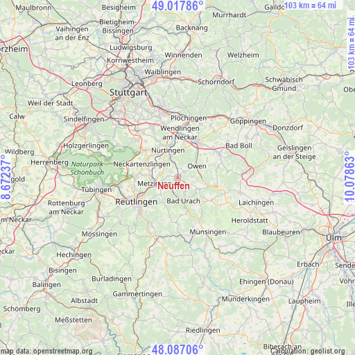
Neuffen GPS coordinates[2]
48° 33' 16.56" North, 9° 22' 31.8" East
| Map corner | latitude | longitude |
|---|---|---|
| Upper-left | 49.01786°, | 8.67237° |
| Center: | 48.5546°, | 9.3755° |
| Lower-right: | 48.08706°, | 10.07863° |
| Map W x H: | 103.5×103.5 km | = 64.3×64.3mi |
| max Lat: | 55.01917° ⇑88.4% North |
| Neuffen: | 48.5546° |
| min Lat: | ⇓11.6% South 47.40724° |
| min Long | Neuffen | max Long |
| 5.92978° | 9.3755° | 14.98853° |
| W 40.3%⇐ | ⇒59.7% E |
Elevation
Elevation of Neuffen is 404 m = 1325 ft, and this is 154.9 m = 508 ft above average elevation for this country.
| Max E: |
1256 m = 4121 ft | 24.2% |
| Neuffen | 404 m 1325 ft | |
| Avg. | 249.1 m = 817 ft | |
Min E: |
-5 m = -16 ft | 75.8% |
See also: Germany elevation on elevation.city.
Geographical zone
Neuffen is located in North temperate zone (between Tropic of Cancer and the Arctic Circle). Distance of this North polar circle is 2002.4 km =1244.2 mi to North.| Distance of | km | miles | from Neuffen |
|---|---|---|---|
| North Pole | 4608.3 | 2863.5 | to North |
| Arctic Circle | 2002.4 | 1244.2 | to North |
| Tropic Cancer | 2792.8 | 1735.4 | to South |
| Equator | 5398.8 | 3354.7 | to South |


Nearby cities:
15 places around Neuffen: (largest is in red/bold)
• Bad Urach
7.3 km =4.5 mi,  165°
165°
• Bempflingen
8.1 km =5 mi,  283°
283°
• Beuren
2.7 km =1.7 mi,  52°
52°
• Dettingen an der Erms
3.5 km =2.2 mi,  220°
220°
• Erkenbrechtsweiler
4.2 km =2.6 mi,  87°
87°
• Frickenhausen
4.5 km =2.8 mi,  345°
345°
• Grabenstetten
7.2 km =4.5 mi,  118°
118°
• Großbettlingen
6.4 km =4 mi,  308°
308°
• Hülben
4.5 km =2.8 mi,  148°
148°
• Kohlberg
3 km =1.9 mi, 278°
• Lenningen
7.5 km =4.7 mi, 93°
• Metzingen
7.1 km =4.4 mi,  253°
253°
• Nürtingen
8.3 km =5.2 mi,  342°
342°
• Owen
6.6 km =4.1 mi,  56°
56°
• Riederich
7.9 km =4.9 mi,  274°
274°
Sources, notices
• [Note1] Compared only with cities in Germany existing in our database
• [Src1] Map data: © OpenStreetMap contributors (CC-BY-SA)
• [Src2] Other city data from geonames.org with taken over terms of usage.
• [Src3] Geographical zone / Annual Mean Temperature by Robert A. Rohde @ Wikipedia
