Glostrup geodata
Glostrup (Capital Region) is a seat of a second-order administrative division; located in Denmark in Europe/Copenhagen (GMT+2) time zone. With population of 20,673 people, there are 38 cities with bigger population in this country. Compared to other cities in Denmark, 55.3% of cities are located further ↑North; 91.2% of cities are located further ←West and 53.5% of cities have higher elevation than Glostrup. Note1


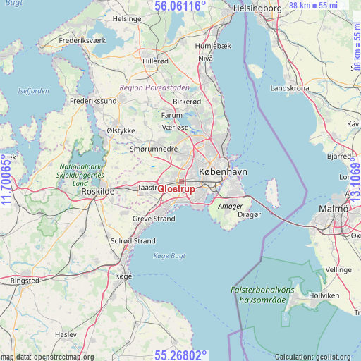
Glostrup GPS coordinates[2]
55° 39' 59.76" North, 12° 24' 13.572" East
| Map corner | latitude | longitude |
|---|---|---|
| Upper-left | 56.06116°, | 11.70065° |
| Center: | 55.6666°, | 12.40377° |
| Lower-right: | 55.26802°, | 13.1069° |
| Map W x H: | 88.2×88.2 km | = 54.8×54.8mi |
| max Lat: | 57.72093° ⇑55.3% North |
| Glostrup: | 55.6666° |
| min Lat: | ⇓44.7% South 54.57644° |
| min Long | Glostrup | max Long |
| 8.12605° | 12.40377° | 15.18662° |
| W 91.2%⇐ | ⇒8.8% E |
Elevation
Elevation of Glostrup is 18 m = 59 ft, and this is 9.3 m = 31 ft below average elevation for this country.
| Max E: |
114 m = 374 ft | 53.5% |
| Avg. | 27.3 m = 90 ft | |
| Glostrup | 18 m = 59 ft | |
Min E: |
0 m = 0 ft | 46.5% |
See also: Denmark elevation on elevation.city.
Geographical zone
Glostrup is located in North temperate zone (between Tropic of Cancer and the Arctic Circle). Distance of this North polar circle is 1211.6 km =752.9 mi to North.| Distance of | km | miles | from Glostrup |
|---|---|---|---|
| North Pole | 3817.5 | 2372.1 | to North |
| Arctic Circle | 1211.6 | 752.9 | to North |
| Tropic Cancer | 3583.6 | 2226.7 | to South |
| Equator | 6189.5 | 3846 | to South |


Nearby cities:
15 places around Glostrup: (largest is in red/bold)
• Albertslund
2.7 km =1.7 mi,  246°
246°
• Ballerup
7.7 km =4.8 mi,  340°
340°
• Brøndbyvester
2.4 km =1.5 mi,  170°
170°
• Buddinge
10.7 km =6.6 mi,  32°
32°
• Copenhagen
10.2 km =6.3 mi,  84°
84°
• Frederiksberg
8.3 km =5.2 mi, 80°
• Herlev
6.7 km =4.2 mi,  19°
19°
• Hvidovre
4.5 km =2.8 mi,  103°
103°
• Ishøj
6.6 km =4.1 mi,  209°
209°
• Rødovre
3.5 km =2.2 mi,  63°
63°
• Smørumnedre
10.5 km =6.5 mi,  323°
323°
• Taastrup
6.7 km =4.2 mi, 253°
• Vallensbæk
5.1 km =3.2 mi,  193°
193°
• Vanløse
5.6 km =3.5 mi,  70°
70°
• Vibekevang
10.5 km =6.5 mi, 65°
Sources, notices
• [Note1] Compared only with cities in Denmark existing in our database
• [Src1] Map data: © OpenStreetMap contributors (CC-BY-SA)
• [Src2] Other city data from geonames.org with taken over terms of usage.
• [Src3] Geographical zone / Annual Mean Temperature by Robert A. Rohde @ Wikipedia
