Smørumnedre geodata
Smørumnedre (Capital Region) is a populated place; located in Denmark in Europe/Copenhagen (GMT+2) time zone. With population of 9,507 people, there are 78 cities with bigger population in this country. Compared to other cities in Denmark, 50% of cities are located further ↓South; 86.8% of cities are located further ←West and 63.2% of cities have lower elevation than Smørumnedre. Note1


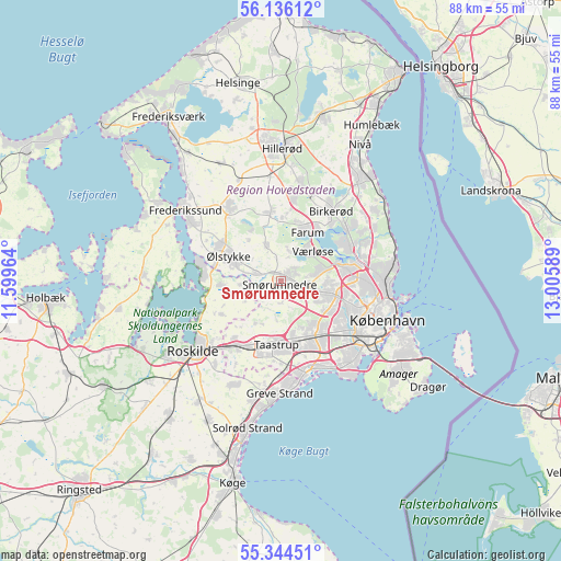
Smørumnedre GPS coordinates[2]
55° 44' 32.352" North, 12° 18' 9.936" East
| Map corner | latitude | longitude |
|---|---|---|
| Upper-left | 56.13612°, | 11.59964° |
| Center: | 55.74232°, | 12.30276° |
| Lower-right: | 55.34451°, | 13.00589° |
| Map W x H: | 88×88 km | = 54.7×54.7mi |
| max Lat: | 57.72093° ⇑50% North |
| Smørumnedre: | 55.74232° |
| min Lat: | ⇓50% South 54.57644° |
| min Long | Smørumnedre | max Long |
| 8.12605° | 12.30276° | 15.18662° |
| W 86.8%⇐ | ⇒13.2% E |
Elevation
Elevation of Smørumnedre is 31 m = 102 ft, and this is 3.7 m = 12 ft above average elevation for this country.
| Max E: |
114 m = 374 ft | 36.8% |
| Smørumnedre | 31 m 102 ft | |
| Avg. | 27.3 m = 90 ft | |
Min E: |
0 m = 0 ft | 63.2% |
See also: Denmark elevation on elevation.city.
Geographical zone
Smørumnedre is located in North temperate zone (between Tropic of Cancer and the Arctic Circle). Distance of this North polar circle is 1203.2 km =747.6 mi to North.| Distance of | km | miles | from Smørumnedre |
|---|---|---|---|
| North Pole | 3809.1 | 2366.9 | to North |
| Arctic Circle | 1203.2 | 747.6 | to North |
| Tropic Cancer | 3592 | 2232 | to South |
| Equator | 6198 | 3851.3 | to South |


Nearby cities:
15 places around Smørumnedre: (largest is in red/bold)
• Albertslund
10.2 km =6.3 mi,  158°
158°
• Ballerup
4 km =2.5 mi,  107°
107°
• Farum
8.2 km =5.1 mi,  26°
26°
• Ganløse
5.9 km =3.7 mi,  336°
336°
• Glostrup
10.5 km =6.5 mi,  143°
143°
• Gundsømagle
9.5 km =5.9 mi,  265°
265°
• Herlev
8.8 km =5.5 mi,  103°
103°
• Lynge
10.9 km =6.8 mi,  351°
351°
• Måløv
1.9 km =1.2 mi,  41°
41°
• Stavnsholt
10.3 km =6.4 mi, 38°
• Stenløse
7.2 km =4.5 mi,  293°
293°
• Taastrup
10.3 km =6.4 mi,  180°
180°
• Veksø
4.3 km =2.7 mi, 288°
• Værløse
6.1 km =3.8 mi, 42°
• Ølstykke
11 km =6.8 mi,  302°
302°
Sources, notices
• [Note1] Compared only with cities in Denmark existing in our database
• [Src1] Map data: © OpenStreetMap contributors (CC-BY-SA)
• [Src2] Other city data from geonames.org with taken over terms of usage.
• [Src3] Geographical zone / Annual Mean Temperature by Robert A. Rohde @ Wikipedia
