Partido geodata
Partido (Dajabón) is a populated place; located in Dominican Republic in America/Santo_Domingo (GMT-4) time zone. With population of 2,170 people, there are 167 cities with bigger population in this country. Compared to other cities in Dominican Republic, 79.6% of cities are located further ↓South; 91.5% of cities are located further →East and 75.4% of cities have lower elevation than Partido. Note1
Administrative division(s):
- Level 1: Dajabón
- Level 2: Partido
- Level 3: Partido
- Level 4: Partido (Zona Urbana)


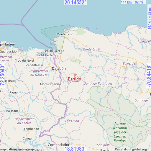
Partido GPS coordinates[2]
19° 29' 2.508" North, 71° 32' 50.28" West
| Map corner | latitude | longitude |
|---|---|---|
| Upper-left | 20.14552°, | -72.25043° |
| Center: | 19.48403°, | -71.5473° |
| Lower-right: | 18.81983°, | -70.84418° |
| Map W x H: | 147.4×147.4 km | = 91.6×91.6mi |
| max Lat: | 19.89131° ⇑20.4% North |
| Partido: | 19.48403° |
| min Lat: | ⇓79.6% South 17.80136° |
| min Long | Partido | max Long |
| -71.85022° | -71.5473° | -68.40431° |
| W 8.5%⇐ | ⇒91.5% E |
Elevation
Elevation of Partido is 200 m = 656 ft, and this is 33.7 m = 111 ft above average elevation for this country.
| Max E: |
1242 m = 4075 ft | 24.6% |
| Partido | 200 m 656 ft | |
| Avg. | 166.3 m = 546 ft | |
Min E: |
5 m = 16 ft | 75.4% |
See also: Dominican Republic elevation on elevation.city.
Geographical zone
Partido is located in North Torrid zone (between Equator and Tropic of Cancer). Distance of this Northern Tropic circle is 439.5 km =273.1 mi to North.| Distance of | km | miles | from Partido |
|---|---|---|---|
| North Pole | 7840.6 | 4871.9 | to North |
| Arctic Circle | 5234.8 | 3252.8 | to North |
| Tropic Cancer | 439.5 | 273.1 | to North |
| Equator | 2166.4 | 1346.1 | to South |


Nearby cities:
15 places around Partido: (largest is in red/bold)
• Cana Chapetón
33.3 km =20.7 mi,  65°
65°
• Castañuelas
26.1 km =16.2 mi,  11°
11°
• Dajabón
18.3 km =11.4 mi,  293°
293°
• El Pino
9.3 km =5.8 mi,  125°
125°
• Hatillo Palma
42 km =26.1 mi,  61°
61°
• Las Matas de Santa Cruz
21.3 km =13.2 mi, 12°
• Loma de Cabrera
7.9 km =4.9 mi,  224°
224°
• Monción
42.2 km =26.2 mi,  101°
101°
• Pepillo Salcedo
31.6 km =19.6 mi,  318°
318°
• Restauración
24.2 km =15 mi, 219°
• Río Limpio
26.6 km =16.5 mi,  176°
176°
• Sabaneta
21.6 km =13.4 mi,  91°
91°
• San Fernando de Monte Cristi
41.8 km =26 mi,  345°
345°
• Villa Elisa
36.7 km =22.8 mi,  52°
52°
• Villa Vásquez
30.5 km =19 mi,  20°
20°
Sources, notices
• [Note1] Compared only with cities in Dominican Republic existing in our database
• [Src1] Map data: © OpenStreetMap contributors (CC-BY-SA)
• [Src2] Other city data from geonames.org with taken over terms of usage.
• [Src3] Geographical zone / Annual Mean Temperature by Robert A. Rohde @ Wikipedia
