Tartu geodata
Tartu is a seat of a first-order administrative division; located in Estonia in Europe/Tallinn (GMT+3) time zone. With population of 101,092 people, there is 1 city with bigger population in this country. Compared to other cities in Estonia, 72.1% of cities are located further ↑North; 77.4% of cities are located further ←West and 71.6% of cities have higher elevation than Tartu. Note1


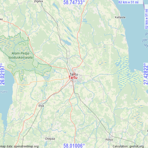
Tartu GPS coordinates[2]
58° 22' 50.232" North, 26° 43' 30.324" East
| Map corner | latitude | longitude |
|---|---|---|
| Upper-left | 58.74733°, | 26.02197° |
| Center: | 58.38062°, | 26.72509° |
| Lower-right: | 58.01006°, | 27.42822° |
| Map W x H: | 82×82 km | = 51×51mi |
| max Lat: | 59.57639° ⇑72.1% North |
| Tartu: | 58.38062° |
| min Lat: | ⇓27.9% South 57.72778° |
| min Long | Tartu | max Long |
| 22.24646° | 26.72509° | 28.19028° |
| W 77.4%⇐ | ⇒22.6% E |
Elevation
Elevation of Tartu is 39 m = 128 ft, and this is 14.2 m = 47 ft below average elevation for this country.
| Max E: |
141 m = 463 ft | 71.6% |
| Avg. | 53.2 m = 175 ft | |
| Tartu | 39 m = 128 ft | |
Min E: |
6 m = 20 ft | 28.4% |
See also: Tartu elevation on elevation.city.
Geographical zone
Tartu is located in North temperate zone (between Tropic of Cancer and the Arctic Circle). Distance of this North polar circle is 909.9 km =565.4 mi to North.| Distance of | km | miles | from Tartu |
|---|---|---|---|
| North Pole | 3515.7 | 2184.6 | to North |
| Arctic Circle | 909.9 | 565.4 | to North |
| Tropic Cancer | 3885.4 | 2414.3 | to South |
| Equator | 6491.3 | 4033.5 | to South |


Nearby cities:
15 places around Tartu: (largest is in red/bold)
• Ahja
28.3 km =17.6 mi,  133°
133°
• Elva
25 km =15.5 mi,  225°
225°
• Ilmatsalu
10.4 km =6.5 mi,  273°
273°
• Koosa
25.5 km =15.8 mi,  52°
52°
• Kurepalu
9.7 km =6 mi,  135°
135°
• Käärdi
26.5 km =16.5 mi,  223°
223°
• Kõrveküla
5.9 km =3.7 mi,  34°
34°
• Lohkva
4.4 km =2.7 mi,  106°
106°
• Luunja
9.5 km =5.9 mi, 106°
• Nõo
16 km =9.9 mi, 223°
• Puhja
24.3 km =15.1 mi,  259°
259°
• Suure-Kambja
17.8 km =11.1 mi,  183°
183°
• Vastse-Kuuste
26.5 km =16.5 mi,  153°
153°
• Võnnu
22 km =13.7 mi,  121°
121°
• Ülenurme
7.2 km =4.5 mi, 179°
Sources, notices
• [Note1] Compared only with cities in Estonia existing in our database
• [Src1] Map data: © OpenStreetMap contributors (CC-BY-SA)
• [Src2] Other city data from geonames.org with taken over terms of usage.
• [Src3] Geographical zone / Annual Mean Temperature by Robert A. Rohde @ Wikipedia
