Suure-Kambja geodata
Suure-Kambja (Tartu) is a populated place; located in Estonia in Europe/Tallinn (GMT+3) time zone. With population of 722 people, there are 124 cities with bigger population in this country. Compared to other cities in Estonia, 81.6% of cities are located further ↑North; 76.8% of cities are located further ←West and 76.8% of cities have lower elevation than Suure-Kambja. Note1


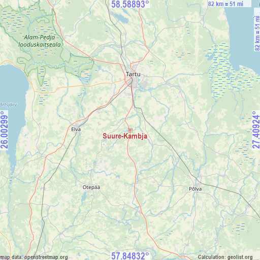
Suure-Kambja GPS coordinates[2]
58° 13' 14.016" North, 26° 42' 21.996" East
| Map corner | latitude | longitude |
|---|---|---|
| Upper-left | 58.58893°, | 26.00299° |
| Center: | 58.22056°, | 26.70611° |
| Lower-right: | 57.84832°, | 27.40924° |
| Map W x H: | 82.3×82.3 km | = 51.1×51.1mi |
| max Lat: | 59.57639° ⇑81.6% North |
| Suure-Kambja: | 58.22056° |
| min Lat: | ⇓18.4% South 57.72778° |
| min Long | Suure-Kambja | max Long |
| 22.24646° | 26.70611° | 28.19028° |
| W 76.8%⇐ | ⇒23.2% E |
Elevation
Elevation of Suure-Kambja is 74 m = 243 ft, and this is 20.8 m = 68 ft above average elevation for this country.
| Max E: |
141 m = 463 ft | 23.2% |
| Suure-Kambja | 74 m 243 ft | |
| Avg. | 53.2 m = 175 ft | |
Min E: |
6 m = 20 ft | 76.8% |
See also: Estonia elevation on elevation.city.
Geographical zone
Suure-Kambja is located in North temperate zone (between Tropic of Cancer and the Arctic Circle). Distance of this North polar circle is 927.7 km =576.4 mi to North.| Distance of | km | miles | from Suure-Kambja |
|---|---|---|---|
| North Pole | 3533.5 | 2195.6 | to North |
| Arctic Circle | 927.7 | 576.4 | to North |
| Tropic Cancer | 3867.6 | 2403.2 | to South |
| Equator | 6473.5 | 4022.4 | to South |


Nearby cities:
15 places around Suure-Kambja: (largest is in red/bold)
• Ahja
21.6 km =13.4 mi,  94°
94°
• Elva
16.7 km =10.4 mi,  270°
270°
• Ilmatsalu
20.7 km =12.9 mi,  333°
333°
• Kanepi
26.6 km =16.5 mi,  173°
173°
• Kurepalu
13.5 km =8.4 mi,  35°
35°
• Käärdi
17.3 km =10.7 mi, 265°
• Kõrveküla
23.1 km =14.4 mi,  11°
11°
• Lohkva
17.4 km =10.8 mi,  18°
18°
• Luunja
18.2 km =11.3 mi,  34°
34°
• Mammaste
26.2 km =16.3 mi,  130°
130°
• Nõo
11.6 km =7.2 mi,  301°
301°
• Tartu
17.8 km =11.1 mi,  3°
3°
• Vastse-Kuuste
14.3 km =8.9 mi,  114°
114°
• Võnnu
21 km =13 mi,  72°
72°
• Ülenurme
10.7 km =6.6 mi, 5°
Sources, notices
• [Note1] Compared only with cities in Estonia existing in our database
• [Src1] Map data: © OpenStreetMap contributors (CC-BY-SA)
• [Src2] Other city data from geonames.org with taken over terms of usage.
• [Src3] Geographical zone / Annual Mean Temperature by Robert A. Rohde @ Wikipedia
