Zarza de Montánchez geodata
Zarza de Montánchez (Extremadura) is a seat of a third-order administrative division; located in Spain in Europe/Madrid (GMT+2) time zone. With population of 608 people, there are 3595 cities with bigger population in this country. Compared to other cities in Spain, 79% of cities are located further ↑North; 86.4% of cities are located further →East and 65.7% of cities have higher elevation than Zarza de Montánchez. Note1
Administrative division(s):
- Level 1: Extremadura
- Level 2: Provincia de Cáceres
- Level 3: Zarza de Montánchez


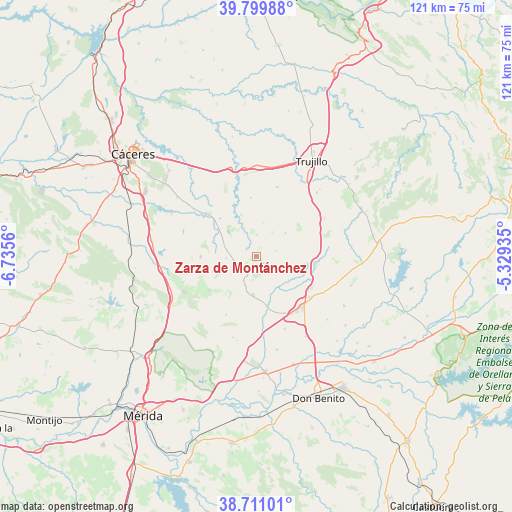
Zarza de Montánchez GPS coordinates[2]
39° 15' 27.216" North, 6° 1' 56.928" West
| Map corner | latitude | longitude |
|---|---|---|
| Upper-left | 39.79988°, | -6.7356° |
| Center: | 39.25756°, | -6.03248° |
| Lower-right: | 38.71101°, | -5.32935° |
| Map W x H: | 121.1×121.1 km | = 75.2×75.2mi |
| max Lat: | 43.74134° ⇑79% North |
| Zarza de Montánchez: | 39.25756° |
| min Lat: | ⇓21% South 27.64134° |
| min Long | Zarza de Montá | max Long |
| -18.00367° | -6.03248° | 4.2899° |
| W 13.6%⇐ | ⇒86.4% E |
Elevation
Elevation of Zarza de Montánchez is 450 m = 1476 ft, and this is 148 m = 486 ft below average elevation for this country.
| Max E: |
1682 m = 5518 ft | 65.7% |
| Avg. | 598 m = 1962 ft | |
| Zarza de Montánchez | 450 m = 1476 ft | |
Min E: |
0 m = 0 ft | 34.3% |
See also: Spain elevation on elevation.city.
Geographical zone
Zarza de Montánchez is located in North temperate zone (between Tropic of Cancer and the Arctic Circle). Distance of this Northern Tropic circle is 1759.1 km =1093.1 mi to South.| Distance of | km | miles | from Zarza de Montánchez |
|---|---|---|---|
| North Pole | 5642 | 3505.8 | to North |
| Arctic Circle | 3036.1 | 1886.5 | to North |
| Tropic Cancer | 1759.1 | 1093.1 | to South |
| Equator | 4365 | 2712.3 | to South |


Nearby cities:
15 places around Zarza de Montánchez: (largest is in red/bold)
• Albalá
13.2 km =8.2 mi,  269°
269°
• Almoharín
9 km =5.6 mi,  185°
185°
• Arroyomolinos de Montánchez
13.7 km =8.5 mi,  234°
234°
• Benquerencia
7.4 km =4.6 mi,  322°
322°
• Botija
10.3 km =6.4 mi,  340°
340°
• Ibahernando
12.4 km =7.7 mi,  52°
52°
• Montánchez
10.7 km =6.6 mi,  250°
250°
• Robledillo de Trujillo
4.7 km =2.9 mi,  73°
73°
• Ruanes
8 km =5 mi,  11°
11°
• Salvatierra de Santiago
5.1 km =3.2 mi,  0°
0°
• Santa Ana
6.7 km =4.2 mi,  32°
32°
• Torre de Santa María
7.2 km =4.5 mi, 267°
• Valdefuentes
7.9 km =4.9 mi,  283°
283°
• Valdemorales
6.4 km =4 mi,  206°
206°
• Villamesías
13.8 km =8.6 mi,  95°
95°
Sources, notices
• [Note1] Compared only with cities in Spain existing in our database
• [Src1] Map data: © OpenStreetMap contributors (CC-BY-SA)
• [Src2] Other city data from geonames.org with taken over terms of usage.
• [Src3] Geographical zone / Annual Mean Temperature by Robert A. Rohde @ Wikipedia
