Ruanes geodata
Ruanes (Extremadura) is a seat of a third-order administrative division; located in Spain in Europe/Madrid (GMT+2) time zone. With population of 80 people, there are 6136 cities with bigger population in this country. Compared to other cities in Spain, 78.4% of cities are located further ↑North; 86.2% of cities are located further →East and 63.6% of cities have higher elevation than Ruanes. Note1


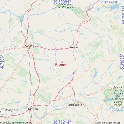
Ruanes GPS coordinates[2]
39° 19' 41.304" North, 6° 0' 48.492" West
| Map corner | latitude | longitude |
|---|---|---|
| Upper-left | 39.86991°, | -6.7166° |
| Center: | 39.32814°, | -6.01347° |
| Lower-right: | 38.78214°, | -5.31035° |
| Map W x H: | 120.9×120.9 km | = 75.1×75.1mi |
| max Lat: | 43.74134° ⇑78.4% North |
| Ruanes: | 39.32814° |
| min Lat: | ⇓21.6% South 27.64134° |
| min Long | Ruanes | max Long |
| -18.00367° | -6.01347° | 4.2899° |
| W 13.8%⇐ | ⇒86.2% E |
Elevation
Elevation of Ruanes is 480 m = 1575 ft, and this is 118 m = 387 ft below average elevation for this country.
| Max E: |
1682 m = 5518 ft | 63.6% |
| Avg. | 598 m = 1962 ft | |
| Ruanes | 480 m = 1575 ft | |
Min E: |
0 m = 0 ft | 36.4% |
See also: Spain elevation on elevation.city.
Geographical zone
Ruanes is located in North temperate zone (between Tropic of Cancer and the Arctic Circle). Distance of this Northern Tropic circle is 1767 km =1098 mi to South.| Distance of | km | miles | from Ruanes |
|---|---|---|---|
| North Pole | 5634.2 | 3500.9 | to North |
| Arctic Circle | 3028.3 | 1881.7 | to North |
| Tropic Cancer | 1767 | 1098 | to South |
| Equator | 4372.9 | 2717.2 | to South |


Nearby cities:
15 places around Ruanes: (largest is in red/bold)
• Benquerencia
6.4 km =4 mi,  251°
251°
• Botija
5.5 km =3.4 mi,  290°
290°
• Ibahernando
8.2 km =5.1 mi,  92°
92°
• La Cumbre
9.1 km =5.7 mi,  20°
20°
• Plasenzuela
6.7 km =4.2 mi,  333°
333°
• Puerto de Santa Cruz
13.4 km =8.3 mi,  95°
95°
• Robledillo de Trujillo
7.1 km =4.4 mi,  156°
156°
• Salvatierra de Santiago
3.2 km =2 mi,  210°
210°
• Santa Ana
3 km =1.9 mi,  137°
137°
• Santa Cruz de la Sierra
14.5 km =9 mi, 86°
• Torre de Santa María
12.1 km =7.5 mi,  227°
227°
• Torremocha
13.9 km =8.6 mi,  278°
278°
• Valdefuentes
11.1 km =6.9 mi,  237°
237°
• Valdemorales
14.3 km =8.9 mi,  198°
198°
• Zarza de Montánchez
8 km =5 mi,  191°
191°
Sources, notices
• [Note1] Compared only with cities in Spain existing in our database
• [Src1] Map data: © OpenStreetMap contributors (CC-BY-SA)
• [Src2] Other city data from geonames.org with taken over terms of usage.
• [Src3] Geographical zone / Annual Mean Temperature by Robert A. Rohde @ Wikipedia
