Puntallana geodata
Puntallana (Canary Islands) is a seat of a third-order administrative division; located in Spain in Atlantic/Canary (GMT+1) time zone. With population of 2,394 people, there are 1946 cities with bigger population in this country. Compared to other cities in Spain, 98.7% of cities are located further ↑North; 99.8% of cities are located further →East and 85.5% of cities have higher elevation than Puntallana. Note1
Administrative division(s):
- Level 1: Canary Islands
- Level 2: Provincia de Santa Cruz de Tenerife
- Level 3: Puntallana


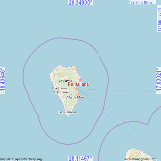
Puntallana GPS coordinates[2]
28° 43' 59.988" North, 17° 43' 59.988" West
| Map corner | latitude | longitude |
|---|---|---|
| Upper-left | 29.34805°, | -18.43646° |
| Center: | 28.73333°, | -17.73333° |
| Lower-right: | 28.11497°, | -17.03021° |
| Map W x H: | 137.1×137.1 km | = 85.2×85.2mi |
| max Lat: | 43.74134° ⇑98.7% North |
| Puntallana: | 28.73333° |
| min Lat: | ⇓1.3% South 27.64134° |
| min Long | Puntallana | max Long |
| -18.00367° | -17.73333° | 4.2899° |
| W 0.2%⇐ | ⇒99.8% E |
Elevation
Elevation of Puntallana is 131 m = 430 ft, and this is 467 m = 1532 ft below average elevation for this country.
| Max E: |
1682 m = 5518 ft | 85.5% |
| Avg. | 598 m = 1962 ft | |
| Puntallana | 131 m = 430 ft | |
Min E: |
0 m = 0 ft | 14.5% |
See also: Spain elevation on elevation.city.
Geographical zone
Puntallana is located in North temperate zone (between Tropic of Cancer and the Arctic Circle). Distance of this Northern Tropic circle is 588.9 km =365.9 mi to South.| Distance of | km | miles | from Puntallana |
|---|---|---|---|
| North Pole | 6812.2 | 4232.9 | to North |
| Arctic Circle | 4206.3 | 2613.7 | to North |
| Tropic Cancer | 588.9 | 365.9 | to South |
| Equator | 3194.8 | 1985.2 | to South |


Nearby cities:
15 places around Puntallana: (largest is in red/bold)
• Barlovento
12.5 km =7.8 mi,  326°
326°
• Breña Alta
10.5 km =6.5 mi,  207°
207°
• Breña Baja
12.7 km =7.9 mi, 205°
• El Paso
17.3 km =10.7 mi,  237°
237°
• Fuencaliente de la Palma
28.9 km =18 mi,  202°
202°
• Garachico
5.8 km =3.6 mi, 328°
• Garafía
21.6 km =13.4 mi,  295°
295°
• Los Llanos de Aridane
19.9 km =12.4 mi,  245°
245°
• Mazo
14.5 km =9 mi, 197°
• Puerto Naos
23.7 km =14.7 mi,  226°
226°
• Puntagorda
24.2 km =15 mi,  280°
280°
• Santa Cruz de la Palma
6.3 km =3.9 mi, 208°
• Tazacorte
22.1 km =13.7 mi, 242°
• Tijarafe
21.5 km =13.4 mi,  260°
260°
• Vallehermosa
76.6 km =47.6 mi,  143°
143°
Sources, notices
• [Note1] Compared only with cities in Spain existing in our database
• [Src1] Map data: © OpenStreetMap contributors (CC-BY-SA)
• [Src2] Other city data from geonames.org with taken over terms of usage.
• [Src3] Geographical zone / Annual Mean Temperature by Robert A. Rohde @ Wikipedia
