Breña Baja geodata
Breña Baja (Canary Islands) is a seat of a third-order administrative division; located in Spain in Atlantic/Canary (GMT+1) time zone. With population of 4,245 people, there are 1430 cities with bigger population in this country. Compared to other cities in Spain, 98.8% of cities are located further ↑North; 99.8% of cities are located further →East and 59.1% of cities have higher elevation than Breña Baja. Note1
Administrative division(s):
- Level 1: Canary Islands
- Level 2: Provincia de Santa Cruz de Tenerife
- Level 3: Breña Baja


Breña Baja GPS coordinates[2]
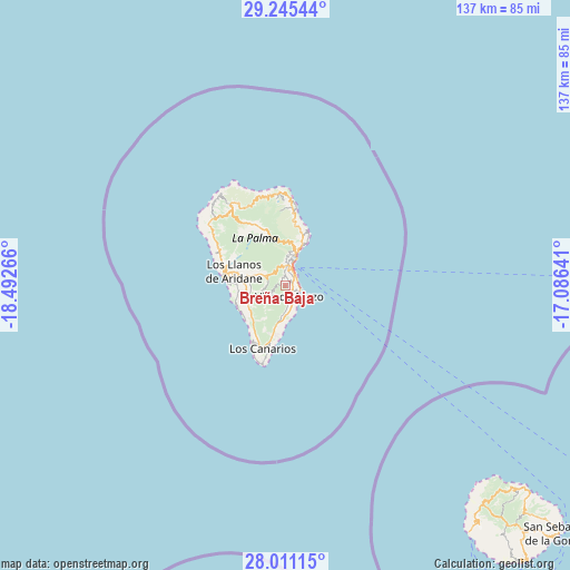
28° 37' 48.396" North, 17° 47' 22.308" West
| Map corner | latitude | longitude |
|---|---|---|
| Upper-left | 29.24544°, | -18.49266° |
| Center: | 28.63011°, | -17.78953° |
| Lower-right: | 28.01115°, | -17.08641° |
| Map W x H: | 137.2×137.2 km | = 85.3×85.3mi |
| max Lat: | 43.74134° ⇑98.8% North |
| Breña Baja: | 28.63011° |
| min Lat: | ⇓1.2% South 27.64134° |
| min Long | Breña Baja | max Long |
| -18.00367° | -17.78953° | 4.2899° |
| W 0.2%⇐ | ⇒99.8% E |
Elevation
Elevation of Breña Baja is 539 m = 1768 ft, and this is 59 m = 194 ft below average elevation for this country.
| Max E: |
1682 m = 5518 ft | 59.1% |
| Avg. | 598 m = 1962 ft | |
| Breña Baja | 539 m = 1768 ft | |
Min E: |
0 m = 0 ft | 40.9% |
See also: Spain elevation on elevation.city.
Geographical zone
Breña Baja is located in North temperate zone (between Tropic of Cancer and the Arctic Circle). Distance of this Northern Tropic circle is 577.5 km =358.8 mi to South.| Distance of | km | miles | from Breña Baja |
|---|---|---|---|
| North Pole | 6823.7 | 4240 | to North |
| Arctic Circle | 4217.8 | 2620.8 | to North |
| Tropic Cancer | 577.5 | 358.8 | to South |
| Equator | 3183.4 | 1978.1 | to South |


Nearby cities:
15 places around Breña Baja: (largest is in red/bold)
• Barlovento
21.9 km =13.6 mi,  356°
356°
• Breña Alta
2.3 km =1.4 mi,  15°
15°
• El Paso
9.4 km =5.8 mi,  283°
283°
• Fuencaliente de la Palma
16.3 km =10.1 mi,  199°
199°
• Garachico
16.6 km =10.3 mi,  8°
8°
• Garafía
25 km =15.5 mi,  325°
325°
• Los Llanos de Aridane
12.9 km =8 mi, 284°
• Mazo
2.6 km =1.6 mi,  154°
154°
• Puerto Naos
12.7 km =7.9 mi,  247°
247°
• Puntagorda
24.4 km =15.2 mi,  311°
311°
• Puntallana
12.7 km =7.9 mi,  25°
25°
• Santa Cruz de la Palma
6.4 km =4 mi, 22°
• Tazacorte
14.2 km =8.8 mi, 275°
• Tijarafe
17.5 km =10.9 mi,  296°
296°
• Vallehermosa
71.6 km =44.5 mi,  134°
134°
Sources, notices
• [Note1] Compared only with cities in Spain existing in our database
• [Src1] Map data: © OpenStreetMap contributors (CC-BY-SA)
• [Src2] Other city data from geonames.org with taken over terms of usage.
• [Src3] Geographical zone / Annual Mean Temperature by Robert A. Rohde @ Wikipedia
