Losa del Obispo geodata
Losa del Obispo (Valencia) is a seat of a third-order administrative division; located in Spain in Europe/Madrid (GMT+2) time zone. With population of 478 people, there are 3938 cities with bigger population in this country. Compared to other cities in Spain, 74.5% of cities are located further ↑North; 78.2% of cities are located further ←West and 65% of cities have higher elevation than Losa del Obispo. Note1
Administrative division(s):
- Level 1: Valencia
- Level 2: Província de València
- Level 3: Losa del Obispo


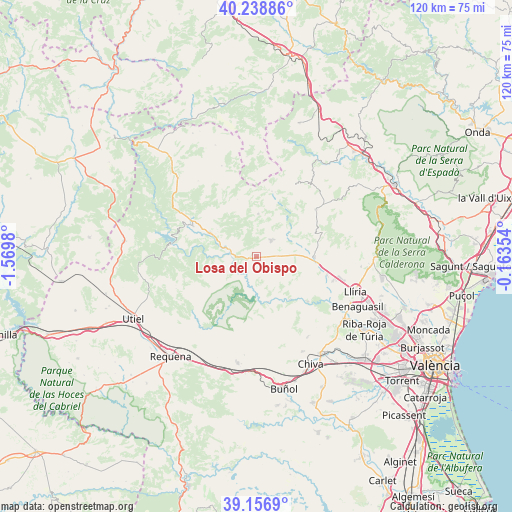
Losa del Obispo GPS coordinates[2]
39° 42' 0" North, 0° 52' 0.012" West
| Map corner | latitude | longitude |
|---|---|---|
| Upper-left | 40.23886°, | -1.5698° |
| Center: | 39.7°, | -0.86667° |
| Lower-right: | 39.1569°, | -0.16354° |
| Map W x H: | 120.3×120.3 km | = 74.8×74.8mi |
| max Lat: | 43.74134° ⇑74.5% North |
| Losa del Obispo: | 39.7° |
| min Lat: | ⇓25.5% South 27.64134° |
| min Long | Losa del Obispo | max Long |
| -18.00367° | -0.86667° | 4.2899° |
| W 78.2%⇐ | ⇒21.8% E |
Elevation
Elevation of Losa del Obispo is 460 m = 1509 ft, and this is 138 m = 453 ft below average elevation for this country.
| Max E: |
1682 m = 5518 ft | 65% |
| Avg. | 598 m = 1962 ft | |
| Losa del Obispo | 460 m = 1509 ft | |
Min E: |
0 m = 0 ft | 35% |
See also: Spain elevation on elevation.city.
Geographical zone
Losa del Obispo is located in North temperate zone (between Tropic of Cancer and the Arctic Circle). Distance of this Northern Tropic circle is 1808.3 km =1123.6 mi to South.| Distance of | km | miles | from Losa del Obispo |
|---|---|---|---|
| North Pole | 5592.8 | 3475.2 | to North |
| Arctic Circle | 2986.9 | 1856 | to North |
| Tropic Cancer | 1808.3 | 1123.6 | to South |
| Equator | 4414.2 | 2742.9 | to South |


Nearby cities:
15 places around Losa del Obispo: (largest is in red/bold)
• Andilla
15.9 km =9.9 mi,  21°
21°
• Bugarra
12.6 km =7.8 mi,  137°
137°
• Calles
9.2 km =5.7 mi,  284°
284°
• Casinos
14.3 km =8.9 mi,  90°
90°
• Chelva
12.4 km =7.7 mi,  296°
296°
• Chera
14 km =8.7 mi,  217°
217°
• Chulilla
5.7 km =3.5 mi,  194°
194°
• Domeño
17.3 km =10.7 mi,  104°
104°
• Gestalgar
11.5 km =7.1 mi,  165°
165°
• Higueruelas
9.4 km =5.8 mi,  8°
8°
• Loriguilla
4.7 km =2.9 mi,  246°
246°
• Pedralba
17 km =10.6 mi,  130°
130°
• Sot de Chera
7.9 km =4.9 mi,  201°
201°
• Tuéjar
16.1 km =10 mi, 297°
• Villar del Arzobispo
5.7 km =3.5 mi,  49°
49°
Sources, notices
• [Note1] Compared only with cities in Spain existing in our database
• [Src1] Map data: © OpenStreetMap contributors (CC-BY-SA)
• [Src2] Other city data from geonames.org with taken over terms of usage.
• [Src3] Geographical zone / Annual Mean Temperature by Robert A. Rohde @ Wikipedia
