La Guancha geodata
La Guancha (Canary Islands) is a seat of a third-order administrative division; located in Spain in Atlantic/Canary (GMT+1) time zone. With population of 5,424 people, there are 1228 cities with bigger population in this country. Compared to other cities in Spain, 99.2% of cities are located further ↑North; 99.5% of cities are located further →East and 62.2% of cities have higher elevation than La Guancha. Note1
Administrative division(s):
- Level 1: Canary Islands
- Level 2: Provincia de Santa Cruz de Tenerife
- Level 3: La Guancha


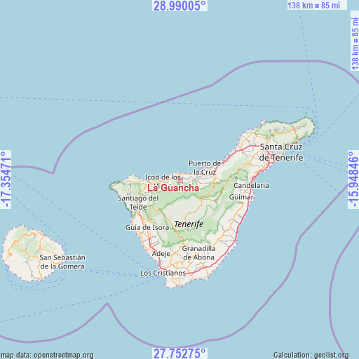
La Guancha GPS coordinates[2]
28° 22' 23.52" North, 16° 39' 5.688" West
| Map corner | latitude | longitude |
|---|---|---|
| Upper-left | 28.99005°, | -17.35471° |
| Center: | 28.3732°, | -16.65158° |
| Lower-right: | 27.75275°, | -15.94846° |
| Map W x H: | 137.6×137.6 km | = 85.5×85.5mi |
| max Lat: | 43.74134° ⇑99.2% North |
| La Guancha: | 28.3732° |
| min Lat: | ⇓0.8% South 27.64134° |
| min Long | La Guancha | max Long |
| -18.00367° | -16.65158° | 4.2899° |
| W 0.5%⇐ | ⇒99.5% E |
Elevation
Elevation of La Guancha is 497 m = 1631 ft, and this is 101 m = 331 ft below average elevation for this country.
| Max E: |
1682 m = 5518 ft | 62.2% |
| Avg. | 598 m = 1962 ft | |
| La Guancha | 497 m = 1631 ft | |
Min E: |
0 m = 0 ft | 37.8% |
See also: Spain elevation on elevation.city.
Geographical zone
La Guancha is located in North temperate zone (between Tropic of Cancer and the Arctic Circle). Distance of this Northern Tropic circle is 548.9 km =341.1 mi to South.| Distance of | km | miles | from La Guancha |
|---|---|---|---|
| North Pole | 6852.3 | 4257.8 | to North |
| Arctic Circle | 4246.4 | 2638.6 | to North |
| Tropic Cancer | 548.9 | 341.1 | to South |
| Equator | 3154.8 | 1960.3 | to South |


Nearby cities:
15 places around La Guancha: (largest is in red/bold)
• Buenavista del Norte
20.5 km =12.7 mi,  270°
270°
• Garachico
10.9 km =6.8 mi, 270°
• Guía de Isora
21.9 km =13.6 mi,  214°
214°
• Icod de los Vinos
5.9 km =3.7 mi, 269°
• La Matanza de Acentejo
21.8 km =13.5 mi,  66°
66°
• La Orotava
12.7 km =7.9 mi,  81°
81°
• La Victoria de Acentejo
19.6 km =12.2 mi, 70°
• Los Realejos
6.9 km =4.3 mi, 79°
• Los Silos
16.1 km =10 mi, 267°
• Puerto de la Cruz
11 km =6.8 mi, 65°
• Realejo Alto
6.5 km =4 mi,  86°
86°
• San Juan de la Rambla
2.2 km =1.4 mi,  3°
3°
• Santa Úrsula
17 km =10.6 mi, 69°
• Santiago del Teide
18.4 km =11.4 mi,  241°
241°
• Tanque
17.8 km =11.1 mi, 267°
Sources, notices
• [Note1] Compared only with cities in Spain existing in our database
• [Src1] Map data: © OpenStreetMap contributors (CC-BY-SA)
• [Src2] Other city data from geonames.org with taken over terms of usage.
• [Src3] Geographical zone / Annual Mean Temperature by Robert A. Rohde @ Wikipedia
