Puerto de la Cruz geodata
Puerto de la Cruz (Canary Islands) is a seat of a third-order administrative division; located in Spain in Atlantic/Canary (GMT+1) time zone. With population of 32,219 people, there are 276 cities with bigger population in this country. Compared to other cities in Spain, 99.1% of cities are located further ↑North; 99.4% of cities are located further →East and 92.3% of cities have higher elevation than Puerto de la Cruz. Note1
Administrative division(s):
- Level 1: Canary Islands
- Level 2: Provincia de Santa Cruz de Tenerife
- Level 3: Puerto de la Cruz


Puerto de la Cruz GPS coordinates[2]
28° 24' 50.292" North, 16° 32' 55.212" West
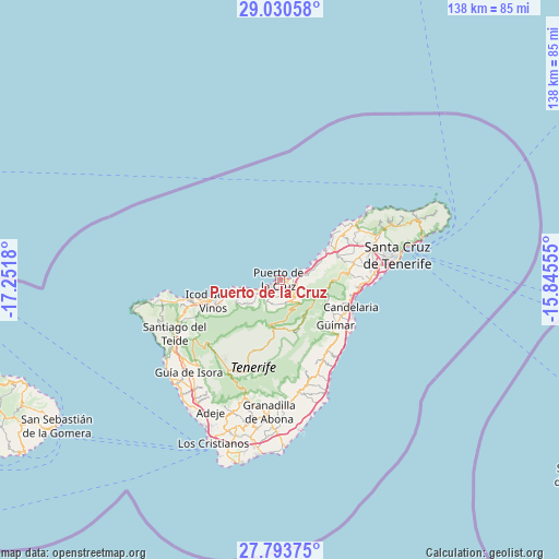
| Map corner | latitude | longitude |
|---|---|---|
| Upper-left | 29.03058°, | -17.2518° |
| Center: | 28.41397°, | -16.54867° |
| Lower-right: | 27.79375°, | -15.84555° |
| Map W x H: | 137.5×137.5 km | = 85.4×85.4mi |
| max Lat: | 43.74134° ⇑99.1% North |
| Puerto de la Cruz: | 28.41397° |
| min Lat: | ⇓0.9% South 27.64134° |
| min Long | Puerto de la Cr | max Long |
| -18.00367° | -16.54867° | 4.2899° |
| W 0.6%⇐ | ⇒99.4% E |
Elevation
Elevation of Puerto de la Cruz is 43 m = 141 ft, and this is 555 m = 1821 ft below average elevation for this country.
| Max E: |
1682 m = 5518 ft | 92.3% |
| Avg. | 598 m = 1962 ft | |
| Puerto de la Cruz | 43 m = 141 ft | |
Min E: |
0 m = 0 ft | 7.7% |
See also: Spain elevation on elevation.city.
Geographical zone
Puerto de la Cruz is located in North temperate zone (between Tropic of Cancer and the Arctic Circle). Distance of this Northern Tropic circle is 553.4 km =343.9 mi to South.| Distance of | km | miles | from Puerto de la Cruz |
|---|---|---|---|
| North Pole | 6847.7 | 4255 | to North |
| Arctic Circle | 4241.8 | 2635.7 | to North |
| Tropic Cancer | 553.4 | 343.9 | to South |
| Equator | 3159.3 | 1963.1 | to South |


Nearby cities:
15 places around Puerto de la Cruz: (largest is in red/bold)
• Arafo
14.9 km =9.3 mi,  123°
123°
• Candelaria
18.4 km =11.4 mi,  110°
110°
• Garachico
21.5 km =13.4 mi,  257°
257°
• Güimar
17.5 km =10.9 mi,  130°
130°
• Icod de los Vinos
16.6 km =10.3 mi,  253°
253°
• La Guancha
11 km =6.8 mi, 245°
• La Matanza de Acentejo
10.8 km =6.7 mi,  66°
66°
• La Orotava
3.6 km =2.2 mi,  135°
135°
• La Victoria de Acentejo
8.7 km =5.4 mi,  76°
76°
• Los Realejos
4.6 km =2.9 mi,  225°
225°
• Realejo Alto
5.5 km =3.4 mi,  221°
221°
• San Juan de la Rambla
10.2 km =6.3 mi, 256°
• Santa Úrsula
6 km =3.7 mi, 77°
• Sauzal
14.2 km =8.8 mi, 65°
• Tacoronte
15.2 km =9.4 mi,  62°
62°
Sources, notices
• [Note1] Compared only with cities in Spain existing in our database
• [Src1] Map data: © OpenStreetMap contributors (CC-BY-SA)
• [Src2] Other city data from geonames.org with taken over terms of usage.
• [Src3] Geographical zone / Annual Mean Temperature by Robert A. Rohde @ Wikipedia
