Henarejos geodata
Henarejos (Castille-La Mancha) is a seat of a third-order administrative division; located in Spain in Europe/Madrid (GMT+2) time zone. With population of 244 people, there are 4780 cities with bigger population in this country. Compared to other cities in Spain, 72.2% of cities are located further ↑North; 73.1% of cities are located further ←West and 92.6% of cities have lower elevation than Henarejos. Note1
Administrative division(s):
- Level 1: Castille-La Mancha
- Level 2: Provincia de Cuenca
- Level 3: Henarejos


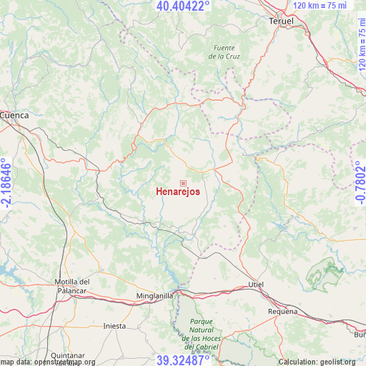
Henarejos GPS coordinates[2]
39° 52' 0.012" North, 1° 28' 59.988" West
| Map corner | latitude | longitude |
|---|---|---|
| Upper-left | 40.40422°, | -2.18646° |
| Center: | 39.86667°, | -1.48333° |
| Lower-right: | 39.32487°, | -0.7802° |
| Map W x H: | 120×120 km | = 74.6×74.6mi |
| max Lat: | 43.74134° ⇑72.2% North |
| Henarejos: | 39.86667° |
| min Lat: | ⇓27.8% South 27.64134° |
| min Long | Henarejos | max Long |
| -18.00367° | -1.48333° | 4.2899° |
| W 73.1%⇐ | ⇒26.9% E |
Elevation
Elevation of Henarejos is 1084 m = 3556 ft, and this is 486 m = 1594 ft above average elevation for this country.
| Max E: |
1682 m = 5518 ft | 7.4% |
| Henarejos | 1084 m 3556 ft | |
| Avg. | 598 m = 1962 ft | |
Min E: |
0 m = 0 ft | 92.6% |
See also: Spain elevation on elevation.city.
Geographical zone
Henarejos is located in North temperate zone (between Tropic of Cancer and the Arctic Circle). Distance of this Northern Tropic circle is 1826.8 km =1135.1 mi to South.| Distance of | km | miles | from Henarejos |
|---|---|---|---|
| North Pole | 5574.3 | 3463.7 | to North |
| Arctic Circle | 2968.4 | 1844.5 | to North |
| Tropic Cancer | 1826.8 | 1135.1 | to South |
| Equator | 4432.8 | 2754.4 | to South |


Nearby cities:
15 places around Henarejos: (largest is in red/bold)
• Alcalá de la Vega
18.7 km =11.6 mi,  351°
351°
• Algarra
15.4 km =9.6 mi,  16°
16°
• Boniches
17.2 km =10.7 mi,  318°
318°
• Campillos-Paravientos
14.2 km =8.8 mi,  336°
336°
• Casas de Garcimolina
15.9 km =9.9 mi, 20°
• Fuentelespino de Moya
5.7 km =3.5 mi,  14°
14°
• Garaballa
11.4 km =7.1 mi,  119°
119°
• Graja de Campalbo
18.9 km =11.7 mi,  78°
78°
• Landete
10.6 km =6.6 mi,  69°
69°
• Mira
17.2 km =10.7 mi,  165°
165°
• Moya
13.6 km =8.5 mi,  47°
47°
• Narboneta
13.1 km =8.1 mi, 173°
• San Martín de Boniches
8 km =5 mi,  297°
297°
• Talayuelas
17.2 km =10.7 mi,  96°
96°
• Villar del Humo
12.8 km =8 mi,  270°
270°
Sources, notices
• [Note1] Compared only with cities in Spain existing in our database
• [Src1] Map data: © OpenStreetMap contributors (CC-BY-SA)
• [Src2] Other city data from geonames.org with taken over terms of usage.
• [Src3] Geographical zone / Annual Mean Temperature by Robert A. Rohde @ Wikipedia
