Famorca geodata
Famorca (Valencia) is a seat of a third-order administrative division; located in Spain in Europe/Madrid (GMT+2) time zone. With population of 61 people, there are 6339 cities with bigger population in this country. Compared to other cities in Spain, 83.9% of cities are located further ↑North; 85.1% of cities are located further ←West and 55.6% of cities have lower elevation than Famorca. Note1


Famorca GPS coordinates[2]
38° 43' 51.636" North, 0° 14' 50.136" West
| Map corner | latitude | longitude |
|---|---|---|
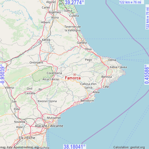
| Upper-left | 39.2774°, | -0.95039° |
| Center: | 38.73101°, | -0.24726° |
| Lower-right: | 38.18041°, | 0.45586° |
| Map W x H: | 122×122 km | = 75.8×75.8mi |
| max Lat: | 43.74134° ⇑83.9% North |
| Famorca: | 38.73101° |
| min Lat: | ⇓16.1% South 27.64134° |
| min Long | Famorca | max Long |
| -18.00367° | -0.24726° | 4.2899° |
| W 85.1%⇐ | ⇒14.9% E |
Elevation
Elevation of Famorca is 713 m = 2339 ft, and this is 115 m = 377 ft above average elevation for this country.
| Max E: |
1682 m = 5518 ft | 44.4% |
| Famorca | 713 m 2339 ft | |
| Avg. | 598 m = 1962 ft | |
Min E: |
0 m = 0 ft | 55.6% |
See also: Spain elevation on elevation.city.
Geographical zone
Famorca is located in North temperate zone (between Tropic of Cancer and the Arctic Circle). Distance of this Northern Tropic circle is 1700.6 km =1056.7 mi to South.| Distance of | km | miles | from Famorca |
|---|---|---|---|
| North Pole | 5700.6 | 3542.2 | to North |
| Arctic Circle | 3094.7 | 1923 | to North |
| Tropic Cancer | 1700.6 | 1056.7 | to South |
| Equator | 4306.5 | 2675.9 | to South |


Nearby cities:
15 places around Famorca: (largest is in red/bold)
• Almudaina
9.6 km =6 mi,  289°
289°
• Balones
8.4 km =5.2 mi,  274°
274°
• Benasau
9.4 km =5.8 mi,  241°
241°
• Beniardá
5.8 km =3.6 mi,  152°
152°
• Benimantell
6.8 km =4.2 mi, 152°
• Benimassot
3.8 km =2.4 mi,  304°
304°
• Castell de Castells
4.8 km =3 mi,  97°
97°
• Confrides
5.5 km =3.4 mi,  199°
199°
• Facheca
1.8 km =1.1 mi,  284°
284°
• Gorga
9.5 km =5.9 mi,  261°
261°
• Millena
10 km =6.2 mi, 269°
• Planes
10.2 km =6.3 mi,  306°
306°
• Tollos
3.7 km =2.3 mi,  319°
319°
• Vall de Ebo
11.3 km =7 mi,  42°
42°
• Vall de Gallinera
10.3 km =6.4 mi,  2°
2°
Sources, notices
• [Note1] Compared only with cities in Spain existing in our database
• [Src1] Map data: © OpenStreetMap contributors (CC-BY-SA)
• [Src2] Other city data from geonames.org with taken over terms of usage.
• [Src3] Geographical zone / Annual Mean Temperature by Robert A. Rohde @ Wikipedia
