Canillas de Albaida geodata
Canillas de Albaida (Andalusia) is a seat of a third-order administrative division; located in Spain in Europe/Madrid (GMT+2) time zone. With population of 797 people, there are 3215 cities with bigger population in this country. Compared to other cities in Spain, 96.4% of cities are located further ↑North; 59.4% of cities are located further →East and 54.2% of cities have higher elevation than Canillas de Albaida. Note1
Administrative division(s):
- Level 1: Andalusia
- Level 2: Provincia de Málaga
- Level 3: Canillas de Albaida


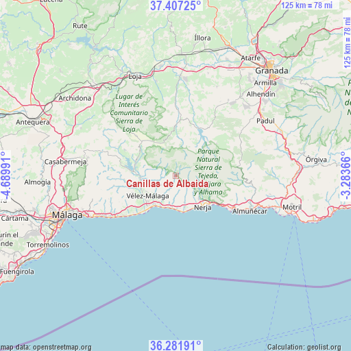
Canillas de Albaida GPS coordinates[2]
36° 50' 47.94" North, 3° 59' 12.408" West
| Map corner | latitude | longitude |
|---|---|---|
| Upper-left | 37.40725°, | -4.68991° |
| Center: | 36.84665°, | -3.98678° |
| Lower-right: | 36.28191°, | -3.28366° |
| Map W x H: | 125.1×125.1 km | = 77.7×77.7mi |
| max Lat: | 43.74134° ⇑96.4% North |
| Canillas de Albaida: | 36.84665° |
| min Lat: | ⇓3.6% South 27.64134° |
| min Long | Canillas de Alb | max Long |
| -18.00367° | -3.98678° | 4.2899° |
| W 40.6%⇐ | ⇒59.4% E |
Elevation
Elevation of Canillas de Albaida is 608 m = 1995 ft, and this is 10 m = 33 ft above average elevation for this country.
| Max E: |
1682 m = 5518 ft | 54.2% |
| Canillas de Albaida | 608 m 1995 ft | |
| Avg. | 598 m = 1962 ft | |
Min E: |
0 m = 0 ft | 45.8% |
See also: Spain elevation on elevation.city.
Geographical zone
Canillas de Albaida is located in North temperate zone (between Tropic of Cancer and the Arctic Circle). Distance of this Northern Tropic circle is 1491 km =926.5 mi to South.| Distance of | km | miles | from Canillas de Albaida |
|---|---|---|---|
| North Pole | 5910.1 | 3672.4 | to North |
| Arctic Circle | 3304.2 | 2053.1 | to North |
| Tropic Cancer | 1491 | 926.5 | to South |
| Equator | 4097 | 2545.8 | to South |


Nearby cities:
15 places around Canillas de Albaida: (largest is in red/bold)
• Alcaucín
12.9 km =8 mi,  298°
298°
• Algarrobo
9.4 km =5.8 mi,  210°
210°
• Arenas
6.1 km =3.8 mi,  236°
236°
• Arenas del Rey
14.9 km =9.3 mi,  33°
33°
• Canillas de Aceituno
9 km =5.6 mi,  288°
288°
• Cómpeta
1.8 km =1.1 mi,  142°
142°
• Frigiliana
10.5 km =6.5 mi,  128°
128°
• Nerja
14.5 km =9 mi, 136°
• Salares
3.5 km =2.2 mi,  284°
284°
• Sayalonga
5.9 km =3.7 mi,  203°
203°
• Sedella
4.5 km =2.8 mi, 292°
• Torrox
10.3 km =6.4 mi,  162°
162°
• Viñuela
13.9 km =8.6 mi, 277°
• Vélez-Málaga
12.6 km =7.8 mi,  234°
234°
• Árchez
0.9 km =0.6 mi, 212°
Sources, notices
• [Note1] Compared only with cities in Spain existing in our database
• [Src1] Map data: © OpenStreetMap contributors (CC-BY-SA)
• [Src2] Other city data from geonames.org with taken over terms of usage.
• [Src3] Geographical zone / Annual Mean Temperature by Robert A. Rohde @ Wikipedia
