Zamayón geodata
Zamayón (Castille and León) is a seat of a third-order administrative division; located in Spain in Europe/Madrid (GMT+2) time zone. With population of 190 people, there are 5108 cities with bigger population in this country. Compared to other cities in Spain, 52.1% of cities are located further ↓South; 83.7% of cities are located further →East and 70% of cities have lower elevation than Zamayón. Note1
Administrative division(s):
- Level 1: Castille and León
- Level 2: Provincia de Salamanca
- Level 3: Zamayón


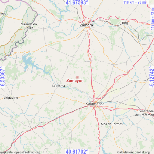
Zamayón GPS coordinates[2]
41° 8' 54.996" North, 5° 49' 49.944" West
| Map corner | latitude | longitude |
|---|---|---|
| Upper-left | 41.67593°, | -6.53367° |
| Center: | 41.14861°, | -5.83054° |
| Lower-right: | 40.61702°, | -5.12742° |
| Map W x H: | 117.7×117.7 km | = 73.1×73.1mi |
| max Lat: | 43.74134° ⇑47.9% North |
| Zamayón: | 41.14861° |
| min Lat: | ⇓52.1% South 27.64134° |
| min Long | Zamayón | max Long |
| -18.00367° | -5.83054° | 4.2899° |
| W 16.3%⇐ | ⇒83.7% E |
Elevation
Elevation of Zamayón is 814 m = 2671 ft, and this is 216 m = 709 ft above average elevation for this country.
| Max E: |
1682 m = 5518 ft | 30% |
| Zamayón | 814 m 2671 ft | |
| Avg. | 598 m = 1962 ft | |
Min E: |
0 m = 0 ft | 70% |
See also: Spain elevation on elevation.city.
Geographical zone
Zamayón is located in North temperate zone (between Tropic of Cancer and the Arctic Circle). Distance of this Northern Tropic circle is 1969.4 km =1223.7 mi to South.| Distance of | km | miles | from Zamayón |
|---|---|---|---|
| North Pole | 5431.8 | 3375.2 | to North |
| Arctic Circle | 2825.9 | 1755.9 | to North |
| Tropic Cancer | 1969.4 | 1223.7 | to South |
| Equator | 4575.3 | 2843 | to South |


Nearby cities:
15 places around Zamayón: (largest is in red/bold)
• Aldearrodrigo
4.7 km =2.9 mi,  155°
155°
• Almenara de Tormes
9.4 km =5.8 mi,  176°
176°
• Añover de Tormes
7.3 km =4.5 mi,  259°
259°
• Calzada de Valdunciel
12.8 km =8 mi,  122°
122°
• Forfoleda
8.8 km =5.5 mi,  129°
129°
• Juzbado
8.3 km =5.2 mi,  198°
198°
• Mayalde
11.7 km =7.3 mi,  13°
13°
• Palacios del Arzobispo
5.3 km =3.3 mi,  292°
292°
• San Pedro del Valle
13.1 km =8.1 mi,  190°
190°
• San Pelayo de Guareña
4.3 km =2.7 mi,  211°
211°
• Santiz
8.4 km =5.2 mi,  319°
319°
• Torresmenudas
6.4 km =4 mi,  143°
143°
• Valdelosa
4.7 km =2.9 mi,  56°
56°
• Valverdón
12.4 km =7.7 mi, 155°
• Zarapicos
12.3 km =7.6 mi, 185°
Sources, notices
• [Note1] Compared only with cities in Spain existing in our database
• [Src1] Map data: © OpenStreetMap contributors (CC-BY-SA)
• [Src2] Other city data from geonames.org with taken over terms of usage.
• [Src3] Geographical zone / Annual Mean Temperature by Robert A. Rohde @ Wikipedia
