Villaturde geodata
Villaturde (Castille and León) is a seat of a third-order administrative division; located in Spain in Europe/Madrid (GMT+2) time zone. With population of 220 people, there are 4917 cities with bigger population in this country. Compared to other cities in Spain, 84.1% of cities are located further ↓South; 68.3% of cities are located further →East and 74.1% of cities have lower elevation than Villaturde. Note1
Administrative division(s):
- Level 1: Castille and León
- Level 2: Provincia de Palencia
- Level 3: Villaturde


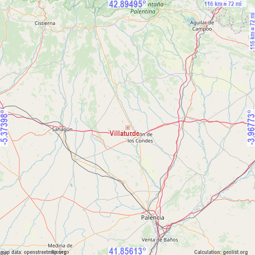
Villaturde GPS coordinates[2]
42° 22' 39.684" North, 4° 40' 15.06" West
| Map corner | latitude | longitude |
|---|---|---|
| Upper-left | 42.89495°, | -5.37398° |
| Center: | 42.37769°, | -4.67085° |
| Lower-right: | 41.85613°, | -3.96773° |
| Map W x H: | 115.5×115.5 km | = 71.8×71.8mi |
| max Lat: | 43.74134° ⇑15.9% North |
| Villaturde: | 42.37769° |
| min Lat: | ⇓84.1% South 27.64134° |
| min Long | Villaturde | max Long |
| -18.00367° | -4.67085° | 4.2899° |
| W 31.7%⇐ | ⇒68.3% E |
Elevation
Elevation of Villaturde is 844 m = 2769 ft, and this is 246 m = 807 ft above average elevation for this country.
| Max E: |
1682 m = 5518 ft | 25.9% |
| Villaturde | 844 m 2769 ft | |
| Avg. | 598 m = 1962 ft | |
Min E: |
0 m = 0 ft | 74.1% |
See also: Spain elevation on elevation.city.
Geographical zone
Villaturde is located in North temperate zone (between Tropic of Cancer and the Arctic Circle). Distance of this Northern Tropic circle is 2106 km =1308.6 mi to South.| Distance of | km | miles | from Villaturde |
|---|---|---|---|
| North Pole | 5295.1 | 3290.2 | to North |
| Arctic Circle | 2689.2 | 1671 | to North |
| Tropic Cancer | 2106 | 1308.6 | to South |
| Equator | 4712 | 2927.9 | to South |


Nearby cities:
15 places around Villaturde: (largest is in red/bold)
• Bustillo de la Vega
10.5 km =6.5 mi,  326°
326°
• Bustillo del Páramo de Carrión
6.2 km =3.9 mi,  246°
246°
• Calzada de los Molinos
5.8 km =3.6 mi,  165°
165°
• Carrión de los Condes
7 km =4.3 mi,  125°
125°
• Cervatos de la Cueza
12.6 km =7.8 mi,  219°
219°
• Nogal de las Huertas
2.9 km =1.8 mi,  55°
55°
• Pedrosa de la Vega
13.1 km =8.1 mi, 331°
• Quintanilla de Onsoña
10.2 km =6.3 mi,  3°
3°
• Renedo de la Vega
8.8 km =5.5 mi,  342°
342°
• Riberos de la Cueza
11.9 km =7.4 mi,  202°
202°
• San Mamés de Campos
9 km =5.6 mi,  106°
106°
• Villalcázar de Sirga
12.5 km =7.8 mi,  122°
122°
• Villamoronta
3.7 km =2.3 mi,  321°
321°
• Villamuera de la Cueza
13.3 km =8.3 mi,  186°
186°
• Villarrabé
10.5 km =6.5 mi,  297°
297°
Sources, notices
• [Note1] Compared only with cities in Spain existing in our database
• [Src1] Map data: © OpenStreetMap contributors (CC-BY-SA)
• [Src2] Other city data from geonames.org with taken over terms of usage.
• [Src3] Geographical zone / Annual Mean Temperature by Robert A. Rohde @ Wikipedia
