Quintanilla de Onsoña geodata
Quintanilla de Onsoña (Castille and León) is a seat of a third-order administrative division; located in Spain in Europe/Madrid (GMT+2) time zone. With population of 220 people, there are 4917 cities with bigger population in this country. Compared to other cities in Spain, 86.5% of cities are located further ↓South; 68.2% of cities are located further →East and 78.9% of cities have lower elevation than Quintanilla de Onsoña. Note1
Administrative division(s):
- Level 1: Castille and León
- Level 2: Provincia de Palencia
- Level 3: Quintanilla de Onsoña


Quintanilla de Onsoña GPS coordinates[2]
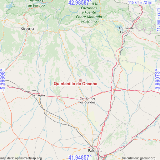
42° 28' 9.732" North, 4° 39' 49.86" West
| Map corner | latitude | longitude |
|---|---|---|
| Upper-left | 42.98587°, | -5.36698° |
| Center: | 42.46937°, | -4.66385° |
| Lower-right: | 41.94857°, | -3.96073° |
| Map W x H: | 115.3×115.3 km | = 71.6×71.6mi |
| max Lat: | 43.74134° ⇑13.5% North |
| Quintanilla de Onsoña: | 42.46937° |
| min Lat: | ⇓86.5% South 27.64134° |
| min Long | Quintanilla de | max Long |
| -18.00367° | -4.66385° | 4.2899° |
| W 31.8%⇐ | ⇒68.2% E |
Elevation
Elevation of Quintanilla de Onsoña is 888 m = 2913 ft, and this is 290 m = 951 ft above average elevation for this country.
| Max E: |
1682 m = 5518 ft | 21.1% |
| Quintanilla de Onsoña | 888 m 2913 ft | |
| Avg. | 598 m = 1962 ft | |
Min E: |
0 m = 0 ft | 78.9% |
See also: Spain elevation on elevation.city.
Geographical zone
Quintanilla de Onsoña is located in North temperate zone (between Tropic of Cancer and the Arctic Circle). Distance of this Northern Tropic circle is 2116.2 km =1314.9 mi to South.| Distance of | km | miles | from Quintanilla de Onsoña |
|---|---|---|---|
| North Pole | 5284.9 | 3283.9 | to North |
| Arctic Circle | 2679 | 1664.7 | to North |
| Tropic Cancer | 2116.2 | 1314.9 | to South |
| Equator | 4722.2 | 2934.2 | to South |


Nearby cities:
15 places around Quintanilla de Onsoña: (largest is in red/bold)
• Bustillo de la Vega
6.5 km =4 mi,  256°
256°
• Bustillo del Páramo de Carrión
14.2 km =8.8 mi,  206°
206°
• Bárcena de Campos
13.6 km =8.5 mi,  83°
83°
• Nogal de las Huertas
8.7 km =5.4 mi,  167°
167°
• Pedrosa de la Vega
6.9 km =4.3 mi,  281°
281°
• Renedo de la Vega
3.7 km =2.3 mi,  241°
241°
• Saldaña
8.3 km =5.2 mi,  314°
314°
• Santervás de la Vega
11.9 km =7.4 mi,  290°
290°
• Villaeles de Valdavia
12.6 km =7.8 mi,  31°
31°
• Villaluenga de la Vega
10.3 km =6.4 mi, 306°
• Villamoronta
7.9 km =4.9 mi,  201°
201°
• Villanuño de Valdavia
12.6 km =7.8 mi,  70°
70°
• Villarrabé
11.3 km =7 mi, 241°
• Villasila de Valdavia
11.1 km =6.9 mi,  51°
51°
• Villaturde
10.2 km =6.3 mi,  183°
183°
Sources, notices
• [Note1] Compared only with cities in Spain existing in our database
• [Src1] Map data: © OpenStreetMap contributors (CC-BY-SA)
• [Src2] Other city data from geonames.org with taken over terms of usage.
• [Src3] Geographical zone / Annual Mean Temperature by Robert A. Rohde @ Wikipedia
