Villares de Órbigo geodata
Villares de Órbigo (Castille and León) is a seat of a third-order administrative division; located in Spain in Europe/Madrid (GMT+2) time zone. With population of 843 people, there are 3142 cities with bigger population in this country. Compared to other cities in Spain, 86.5% of cities are located further ↓South; 84.8% of cities are located further →East and 72.3% of cities have lower elevation than Villares de Órbigo. Note1
Administrative division(s):
- Level 1: Castille and León
- Level 2: Provincia de León
- Level 3: Villares de Órbigo


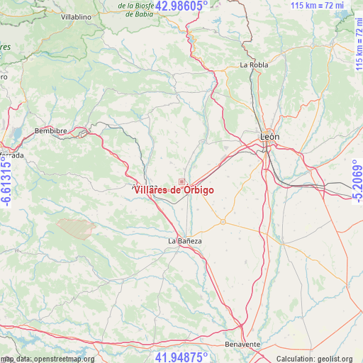
Villares de Órbigo GPS coordinates[2]
42° 28' 10.38" North, 5° 54' 36.072" West
| Map corner | latitude | longitude |
|---|---|---|
| Upper-left | 42.98605°, | -6.61315° |
| Center: | 42.46955°, | -5.91002° |
| Lower-right: | 41.94875°, | -5.2069° |
| Map W x H: | 115.3×115.3 km | = 71.6×71.6mi |
| max Lat: | 43.74134° ⇑13.5% North |
| Villares de Órbigo: | 42.46955° |
| min Lat: | ⇓86.5% South 27.64134° |
| min Long | Villares de Ór | max Long |
| -18.00367° | -5.91002° | 4.2899° |
| W 15.2%⇐ | ⇒84.8% E |
Elevation
Elevation of Villares de Órbigo is 829 m = 2720 ft, and this is 231 m = 758 ft above average elevation for this country.
| Max E: |
1682 m = 5518 ft | 27.7% |
| Villares de Órbigo | 829 m 2720 ft | |
| Avg. | 598 m = 1962 ft | |
Min E: |
0 m = 0 ft | 72.3% |
See also: Spain elevation on elevation.city.
Geographical zone
Villares de Órbigo is located in North temperate zone (between Tropic of Cancer and the Arctic Circle). Distance of this Northern Tropic circle is 2116.3 km =1315 mi to South.| Distance of | km | miles | from Villares de Órbigo |
|---|---|---|---|
| North Pole | 5284.9 | 3283.9 | to North |
| Arctic Circle | 2679 | 1664.7 | to North |
| Tropic Cancer | 2116.3 | 1315 | to South |
| Equator | 4722.2 | 2934.2 | to South |


Nearby cities:
15 places around Villares de Órbigo: (largest is in red/bold)
• Astorga
12 km =7.5 mi,  264°
264°
• Benavides
4.1 km =2.5 mi,  18°
18°
• Bustillo del Páramo
10.1 km =6.3 mi,  108°
108°
• Hospital de Órbigo
2.1 km =1.3 mi, 109°
• Riego de la Vega
10.5 km =6.5 mi,  213°
213°
• San Cristóbal de la Polantera
8.8 km =5.5 mi,  178°
178°
• San Justo de la Vega
9 km =5.6 mi, 261°
• Santa Marina del Rey
6.3 km =3.9 mi,  39°
39°
• Santa María de la Isla
12.8 km =8 mi,  186°
186°
• Turcia
7.7 km =4.8 mi, 19°
• Valderrey
12.4 km =7.7 mi,  227°
227°
• Villadangos del Páramo
12.8 km =8 mi,  65°
65°
• Villaobispo de Otero
12.6 km =7.8 mi,  285°
285°
• Villarejo de Órbigo
2.7 km =1.7 mi,  170°
170°
• Villazala
12.8 km =8 mi,  159°
159°
Sources, notices
• [Note1] Compared only with cities in Spain existing in our database
• [Src1] Map data: © OpenStreetMap contributors (CC-BY-SA)
• [Src2] Other city data from geonames.org with taken over terms of usage.
• [Src3] Geographical zone / Annual Mean Temperature by Robert A. Rohde @ Wikipedia
